Limited-Time Offer: Save $50 on a Biltmore® Annual Pass
Buy Your Pass

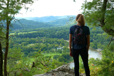
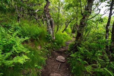
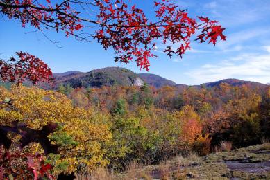
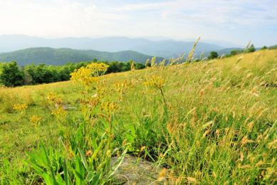
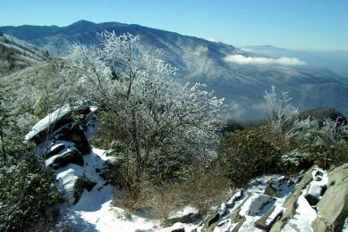
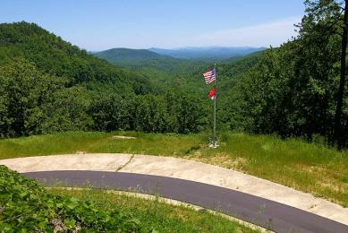
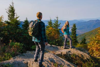
North Carolina is known as the Great Trails State, and with good cause. We have 3,000+ miles of free, public hiking trails near Asheville, including 1,600 miles in the Pisgah and Nantahala National Forests, 850 miles in the Great Smoky Mountains National Park, and many more along the Blue Ridge Parkway and in state parks and forests.
We always encourage you to "Leave No Trace" when exploring trails, and we're excited to partner with Brevard's “Leave It Better” program, taking it a step further! The "Leave It Better" program is designed to inspire explorers of our natural lands to leave it better than they found it with a six-step, easy-to-follow checklist you can put into practice each time you get outdoors. Happy trails! Read more about Brevard's "Leave It Better" program.
Where are the best Asheville hiking trails and areas? Here are our favorite scenic day hikes near Asheville in our mountains. We feature hikes for all skill levels, from easy hikes to more extreme ones, located in 16 counties in Western North Carolina. When selecting trails, we use the following criteria:
- The hiking trailhead is easy to find and within 100 miles of Asheville, NC.
- The hiking trail is safe, marked, and maintained.
- The hike does not require any special equipment, technical skills, or special shoes.
To help you plan, see our Hiking & Waterfall Safety Tips. Looking for the best camping near Asheville? See our top camping spots in the WNC mountains. Also see: 10 Accessible Paved Trails | Top 20 Summit Hikes | 70 Outdoor Things to Do
Guided Hikes from Three Little Bears Retreat
Set just outside Bryson City, this elevated Smoky Mountain retreat makes a memorable home base for hikers, pairing luxury cabins and lodges with guided hikes, all-inclusive options, and easy access to trails, summits, and waterfalls.
More Information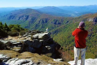
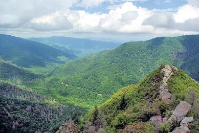
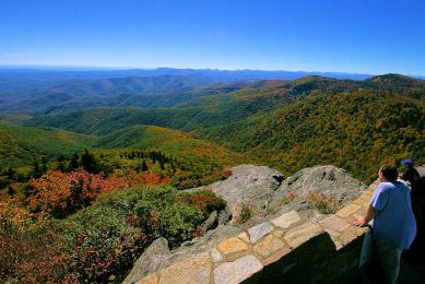
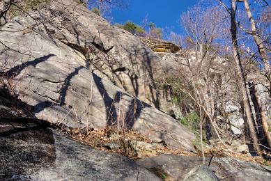
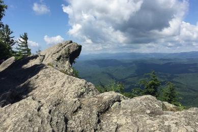
Hawksbill Mountain
(1.5 miles round-trip, moderate) Enjoy spectacular mountaintop views overlooking Linville Gorge. We love to hike this and nearby Table Rock on the same day! Take a picnic.
Mt. LeConte & Alum Cave
(11 miles round-trip, strenuous) The Alum Cave Trail is the most-hiked in the Great Smoky Mountains. You'll see why, with interesting geological features and stunning views. To reach the 6,593-ft…
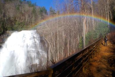
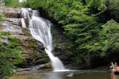
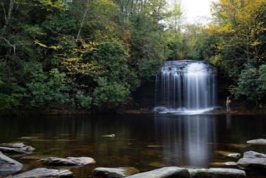
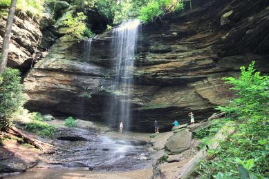
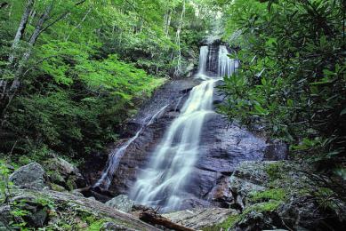
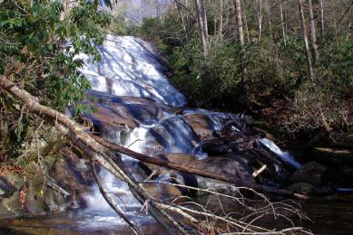
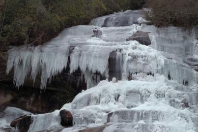
Rainbow Falls
(3 miles round-trip, moderate) This majestic 150-ft. waterfall in the Pisgah National Forest can be reached via a hiking trail from Gorges State Park. Enjoy the falls safely on a boulder at its…
Mt. Mitchell Deep Gap Trail to Mt. Craig
(Up to 9 miles round-trip, moderate) Our favorite quick hike at Mount Mitchell is the Deep Gap Trail to Mt. Craig, a two-mile round-trip hike. Continue on the Deep Gap Trail for another 3.5 miles…
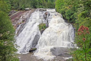
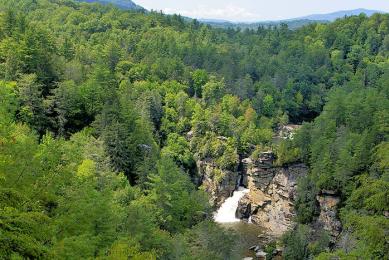
Crabtree Falls
(3 miles round-trip, moderate) This gorgeous 70-ft. waterfall along the Blue Ridge Parkway (Milepost 339), near Linville Falls, is accessed by a very scenic, loop woodland hiking trail.
Forest Therapy - Certified Forest Therapy Trails in Jackson County, NC
Jackson County, NC offers two Certified Forest Therapy Trails near Asheville, designed for mindful forest bathing. These sensory-focused paths promote relaxation, stress relief, and wellness.
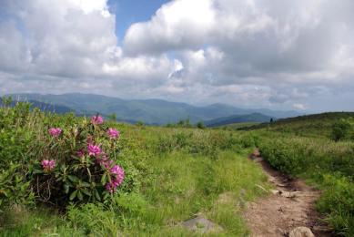
Rough Ridge
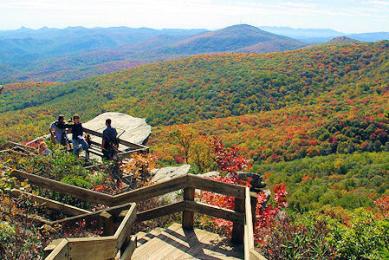
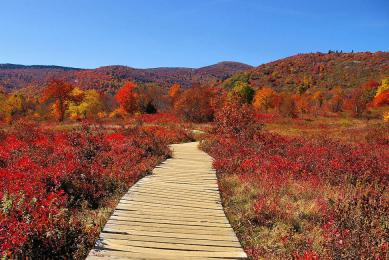
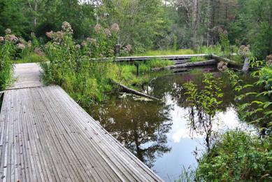
(1.5 to 8 miles round-trip, moderate to strenuous) This unique hike offers plenty of breathtaking viewpoints and a wooden boardwalk over fragile vegetation. The Tanawha Trail features many rock…
Looking Glass Rock
(6.5 miles roundtrip, strenuous) For 180+ degree views from a rock face, hike to the top of this iconic summit in the Pisgah National Forest. You'll hike the "backside" of the mountain, gaining 1,…
Max Patch on Appalachian Trail
(1.4 or 2.4 miles, moderate) Hike a section of the famous Appalachian National Scenic Trail (or AT) near Hot Springs. What a picnic spot with 360-degree mountain views! The 1.4-mile short loop…
Hiking Trails in Brevard, NC
Featuring Kid-Friendly, Easy, Moderate, and Difficult hikes, Transylvania County is a hiker’s paradise, and each season offers something unique to experience. Whether your looking for scenic…
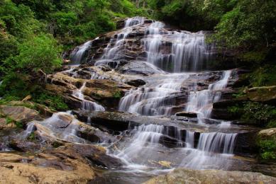
Graveyard Fields
(1-4-mile options, moderate) This very popular spot features two waterfalls in a mile-high valley filled with wildflowers and surrounded by Blue Ridge Mountains' 6,000-ft. peaks. Second Falls is…
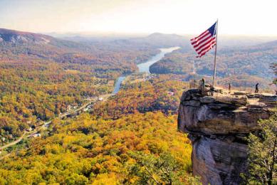
Chimney Rock Park Hikes
(1 to 4 miles, easy to strenuous) Hike a variety of trails with spectacular views of Hickory Nut Gorge or a 400-foot waterfall. Often overlooked, the challenging Four Seasons Trail begins near the…
Craggy Gardens Hikes
(1.5 to 3 miles, moderate) For one of the best panoramic mountain views in western North Carolina, hike the 3/4-mile Craggy Pinnacle Trail to the observation area. Also hike the Craggy Gardens…
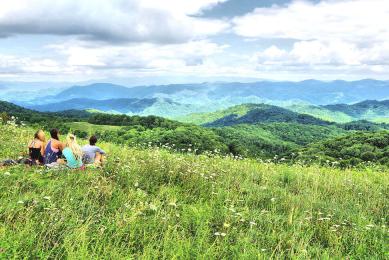
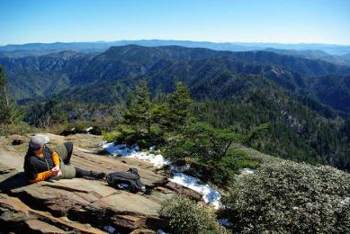
Black Balsam Knob
(1-10 miles, moderate) For sweeping 360-degree views, hike across these bald mountaintops. Almost entirely devoid of trees above 6,000 ft., the summit is more reminiscent of New England than North…
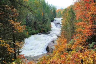
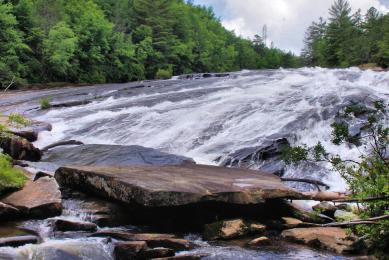
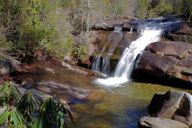
3-Mile Waterfall Hike, DuPont State Forest
(3 miles, moderate) Our most popular waterfall hike takes you to the Hooker, Triple, and High falls in DuPont State Recreational Forest. Take a picnic! Since it's so beautiful, expect big crowds…
Roan Mountain Appalachian Trail
Note: Roan Mountain Recreation Area will be closed during repairs for the 2024 season. The area to be closed includes the rhododendron gardens, Roan High Bluff, Cloudland parking area,…
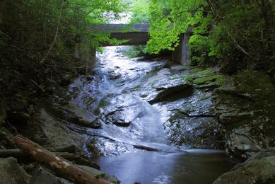
Deep Creek Waterfall Hike
(2.5 miles, moderate) Hike to three waterfalls in the Great Smoky Mountains National Park on this loop trail at Deep Creek, near Bryson City.
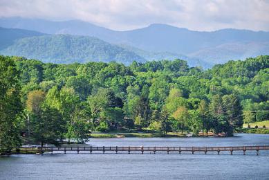
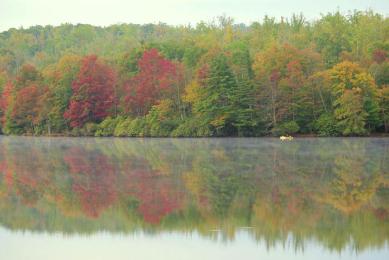
Lake Junaluska Walking Trail
(2.3 or 3.8 miles, easy) Our top accessible, paved hiking trail near Asheville, with a walk around a beautiful lake at the Conference and Retreat Center, surrounded by mountains and historic…
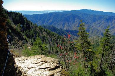
Chimney Tops
(4 miles round-trip, strenuous) One of the most popular hikes in the Great Smoky Mountains. With an elevation of 4,800 ft., the rocky summit is one of the park's most recognizable geological…

Secret Falls
Located near Highlands, this 50-ft. waterfall cascades into an idyllic pool perfect for wading and swimming. It's a short hike in Nantahala National Forest.
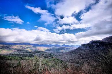
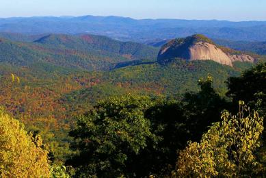
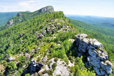
Whiteside Mountain
(2-mile loop hike, moderate) A landmark in the Nantahala National Forest, located between Cashiers and Highlands, Whiteside rises to an elevation of 4,930 ft.. A loop trail takes you to…
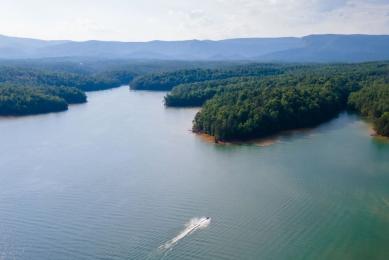
High Falls at Lake Glenville
(1.5 miles round-trip, strenuous) Also known as Cullowhee Falls, this 150-ft. waterfall at Lake Glenville near Cashiers becomes the most powerful a few days of the year when extra water is…
Schoolhouse Falls
(2.5-mile round-trip hike, moderate) This waterfall in Panthertown Valley in Nantahala National Forest is small, but really big on beauty with a great pool for a splash. Extend your hike to a 5-…
7-Mile Waterfalls Hike, DuPont State Forest
(7 miles roundtrip, strenuous) See three waterfalls on this hike in DuPont State Forest: High Falls, Triple Falls and Bridal Veil Falls. Or you can mountain bike most of it on old logging…
Catawba Falls Trail
(3.5 miles roundtrip, intermediate) This waterfall in the Pisgah National Forest is just three miles from I-40 in Old Fort. Hike the 1.1 mile River Trail to the Lower Catawba Falls, a 250-foot…
Wildcat Rock Trail
(6 miles roundtrip, strenuous) This gorgeous new trail in the Hickory Nut Gorge area climbs 1,800 feet in elevation by cliffs, 100-foot Little Bearwallow Falls cascade and panoramic views from…
Lover's Leap Hike
(3.2-mile loop, moderate) Hike from downtown Hot Springs via the Appalachian Trail. You will climb to a rock outcropping for beautiful views of the river and town. It's a romantic…
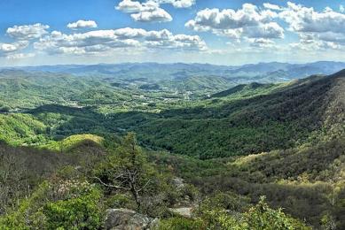
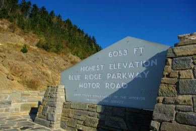
Blue Ridge Parkway Top 15 Short Hikes
Find our favorite short hikes along the Blue Ridge Parkway near Asheville, ranging from easy strolls to strenuous climbs. Also see ranger-led guided hikes held weekly in summer and fall.
Beech Mountain Hikes
(1 to 20 miles, easy to strenuous) The Town of Beech Mountain, the highest town in eastern America, has 20 miles of maintained trails atop their mountain. A great place to keep cool since their…
NC Arboretum Hikes
(Many options, easy to moderate) Located just 10 miles south of downtown, the Arboretum has 10 miles of easy to moderate walking and biking trails. Our pick is the Natural Garden Trail, a one-mile…
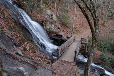
Moore Cove Falls
(1.5 miles roundtrip, easy) Walk behind this 50-foot waterfall located near the popular Looking Glass Falls. Beautiful hike along the way. While the water flow is not impressive, it's a beautiful…
Linville Falls Hikes
(1 to 4 miles roundtrip, moderate) This is probably the most photographed waterfall in North Carolina. Hike to one or all five viewpoints via two trails that leave the Visitors Center. Only one of…
Big Butt Trail
(4.5 miles round-trip, strenuous) This lofty hike keeps you above 5,000 ft. elevation as you hike to Point Misery and Little Butt, so it's perfect for a hot summer's day. On the Blue Ridge Parkway…
Huckleberry Knob
(2.5 miles roundtrip, easy) Located along the very scenic Cherohala Skyway, this 5,560-foot bald summit has 360-degree views of the Nantahala National Forest. Near Robbinsville.
Dill Falls and Upper Dill Falls
(1 mile round-trip, easy) Hike to two waterfalls, Upper and Lower Dill Falls, via easy walks from the end of a forest service road deep in Nantahala National Forest. 4.6 miles from the Blue Ridge…
Glen Falls
(2 miles roundtrip, moderate) A scenic hike takes you to this waterfall in the Highlands area, deep in the Nantahala National Forest. You'll see two separate cascades, so you get two waterfalls…
Bridal Veil Falls, DuPont State Forest
(4.4 miles roundtrip hike, moderate) This beautiful 120-foot waterfall is near High Falls and other DuPont Forest falls and lakes. Hike or bike to it. Many hike combinations due to a network of…
Flat Rock Trail, Blue Ridge Parkway
(6/10 mile, easy) Hike a loop trail to a flat rock summit with expansive views and great picnic spots. Hidden away at Milepost 308.3 on the Blue Ridge Parkway - near Linville Falls.
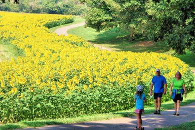
Biltmore Estate Hiking Trails
(Many options, easy to moderate) There are 23 miles of trails, for all fitness levels, to explore at Biltmore. You can walk several miles around the gardens near the house, including a…
Chimneys Hike, Linville Gorge
(1.5 miles round-trip, moderate) Hike across and through towering rock formations called the Chimneys atop the rim of the spectacular Linville Gorge, starting at the Table Rock trailhead parking…
Mount Pisgah
(3 miles round-trip, strenuous) Mount Pisgah can be seen from downtown Asheville on a clear day. Hike up to the top of the 5,721-ft. summit on this popular hiking trail. Blue Ridge Parkway…
Holmes Educational State Forest
(.5-3.5 miles, easy to strenuous) Hike a variety of trails and learn about the forest in this largely unknown gem near busy DuPont State Forest. Open mid March-mid November, find a tranquil and…
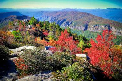
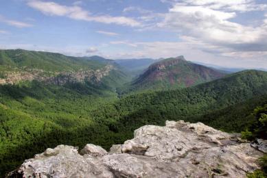
Table Rock Mountain
(2.2 miles round-trip, moderate) Hike to the top of one of the most recognized peaks in the Blue Ridge Mountains. This trailhead is just five miles from Hawksbill, so you can double your fun.
Shortoff Mountain
(4.5 miles round-trip, strenuous) Located near Lake James, a beauty of a hike to the top of a plateau summit with spectacular views of Linville Gorge.
Cedar Rock Mountain, DuPont Forest
(4.5 miles loop, moderate) This hike provides wonderful views and dramatic scenery - and it's not difficult. Rising only a few hundred feet above the surrounding plateau, walk across areas of…
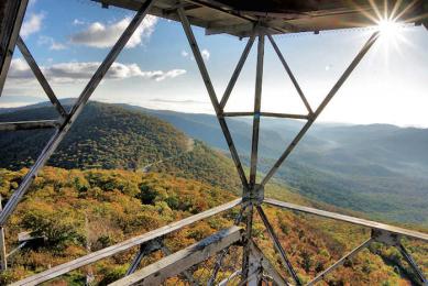
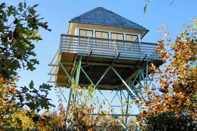
Fryingpan Tower
(1.5 miles round-trip, moderate) See panoramic views of Pisgah National Forest from atop the historic fire tower near Mt Pisgah. Blue Ridge Parkway Milepost 409.6.
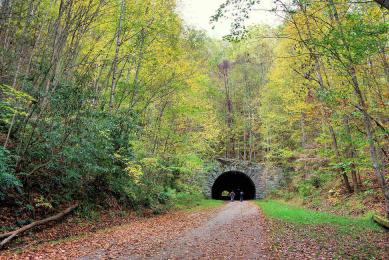
Road to Nowhere Hike
(3.2 miles, moderate) This loop hike in the Smokies includes a 1,200-ft. tunnel at the end of Bryson City's Lakeview Drive, known locally as the "Road to Nowhere." Lakeshore Trail starts here too…
DuPont State Forest Hidden Lakes
(4 miles, moderate) Discover some hidden lakes on the quieter side of DuPont State Recreational Forest, as well as an airstrip with a great mountain view. Fawn Lake and Lake Julia are great…
Cold Mountain
(10.6 miles roundtrip, strenuous) Journey to the summit of the mountain made famous by the novel and movie, in the beautiful Shining Rock Wilderness Area of the Pisgah National Forest.
Wintergreen Falls, DuPont State Forest
(3 miles roundtrip, easy) This 20-ft. waterfall is tucked away in the beautiful setting of DuPont Forest. The hiking trail is gentle - you can also mountain bike or horseback ride.
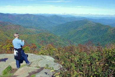
Devil's Courthouse
(1 mile round-trip, moderate) This short-but-steep trail climbs a half-mile to the peak for spectacular views. The bare rock profile named Devil's Courthouse is sinister in appearance and legend.…
Top 10 Hikes, Great Smoky Mountains Park NC
From world-renowned hiking trails like the AT to lesser-known gems, see our favorite 10 hikes from the North Carolina side of the Great Smoky Mountains National Park, nearest the Asheville area.…
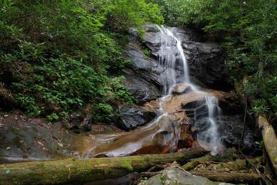
Log Hollow Falls
(1 mile round-trip, easy) Located near Looking Glass Falls, this 25-ft. waterfall is often missed since it's off the beaten path in Pisgah National Forest.
Mt. Sterling
(5.4 miles round-trip, strenuous) Atop Mt. Sterling (5,842 ft. elevation) is the historic, 60-ft. tall steel fire lookout tower with nice views. You will climb 2,000 ft. in elevation.
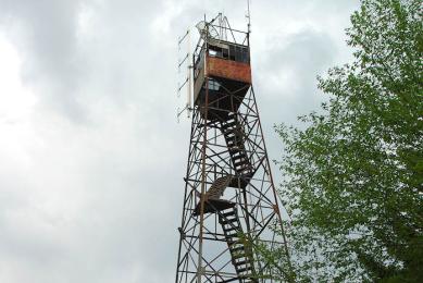
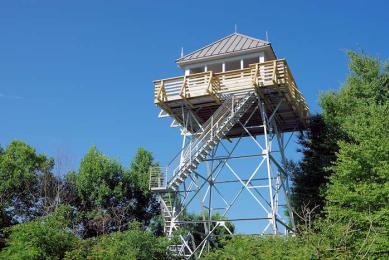
Green Knob Tower
(1 mile roundtrip, moderate) Get a close up view of the historic fire lookout tower visible from the Blue Ridge Parkway - with views Mt. Mitchell from its staircase. Parkway Milepost 350.
Rumbling Bald Trail
(1.5 miles, moderate) Hike this loop trail in Chimney Rock State Park to the boulders and cliffs of Rumbling Bald Mountain, a popular rock climbing spot. Free access area near Lake Lure.
Wildcat Falls
This cascade in Pisgah National Forest is about a 1.5-mile roundtrip hike from a campsite along NC Highway 215, and less than a mile from the Blue Ridge Parkway. It's along the Flat Laurel Creek…
Rich Mountain Lookout Fire Tower
Drive to or hike the Appalachian Trail to enjoy the panoramic mountain views from atop the historic lookout tower near Hot Springs.
Panthertown Valley
(5-mile loop, moderate) Hike 30 miles in this wilderness area with waterfalls and dramatic cliffs. A great half day hike is a five-mile loop to Schoolhouse Falls, Greenland Creek Falls and…
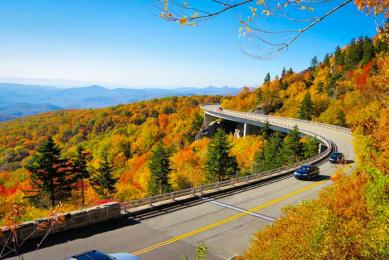
Linn Cove Viaduct
(1 to 8 miles roundtrip, moderate) Hike under and above the Viaduct from the visitor center. Hike south to Beacon Heights or continue north on the Tanawha Trail to Rough Ridge. Blue Ridge Parkway…
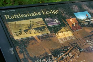
Rattlesnake Lodge
(2.8 miles roundtrip, moderate) Hike back in time as you discover the rock foundations of Rattlesnake Lodge, an early 1900s family retreat. The hike is only a 30-minute drive from downtown…
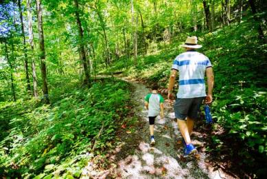
Kid-Friendly Hikes
Find hiking trails ideal for children that aren't too long or strenuous with kid-friendly highlights like waterfalls, picnic areas, paved trails for strollers and more. Also find tips for hiking…
Cove Creek Falls
Located near Daniel Ridge Falls is a waterfall on a beautiful two-mile hike that includes a second, smaller cascade. It's also located near the Pisgah Center for Wildlife Education.
Beacon Heights
(1 mile round-trip, easy) A quick walk to the summit has a big payoff with spectacular views from several rock platforms to explore safely. Take a picnic! Blue Ridge Parkway Milepost 305.
Art Loeb Trail
This challenging, 30-mile hiking trail with spectacular views includes popular Black Balsam Knob. This trail is located in Pisgah National Forest and is a great option for…
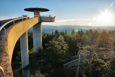
Kuwohi Trail (Formerly Clingmans Dome Trail)
(1 mile round-trip, moderate) At 6,643 ft., this is the highest point in the Great Smoky Mountains National Park. An uphill, paved trail takes you to the top for panoramic views from the…
Setrock Creek & Roaring Fork Falls
(2 miles roundtrip, easy) Take two one-mile roundtrip waterfall hikes, just a few miles off the Blue Ridge Parkway (exit onto NC 80) near Mt. Mitchell.
Bearwallow Mountain
(1 mile roundtrip, moderate) Near Chimney Rock, hike to the summit of this bald mountain with wonderful views. It's an easy drive from downtown Asheville!
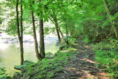
Laurel River Trail
(7 miles roundtrip, easy) This scenic creekside trail follows Big Laurel Creek as it flows to the French Broad River in Pisgah National Forest near Hot Springs.
Cradle of Forestry
(2 miles loop, easy) Walk paved, accessible trails to see restored buildings from the early 1900s and learn about how forestry began in the United States. Perfect for strollers, wheelchairs and…
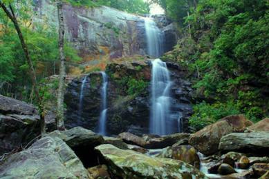
Twin Falls
(6.5 mile loop, strenuous) This twin waterfall near Looking Glass Falls features two 100-foot cascades in view of each other, reached via a beautiful 4.5-mile roundtrip or 6.5-mile loop hike on…
Trombatore Trail
(5 miles roundtrip, strenuous) Adjacent to the Bearwallow Mountain trail is this woodland trail to the grassy summit of Blue Ridge Pastures in the Hickory Nut Gorge area, just 19 miles from…
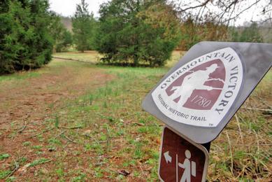
Alexander's Ford Overmountain Trail
(1.5 miles, easy) Hike a section of the Overmountain Victory National Historic Trail that was used for by local militia heading to an important battle in the Revolutionary War.
Stone Mountain, DuPont State Forest
(2.4 miles roundtrip, moderate) A mostly wooded hike with a gradual climb takes you to the top of a rock face with great views across DuPont State Recreational Forest.
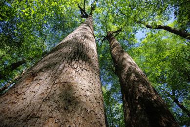
Joyce Kilmer Memorial Forest
(2 miles loop, easy) See an old growth cove hardwood forest with 400-year old towering poplar trees. Near Lake Santeetlah in the Nantahala National Forest, it is about 100 miles west of Asheville…
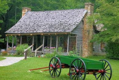
Hiking at Carl Sandburg Home
(Up to 5 miles, easy to moderate) The trail network at Carl Sandburg Home National Historic Site in the village of Flat Rock takes you through the farm by ponds, barn with goats, historic…
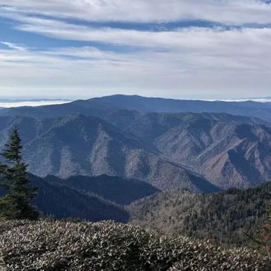
Charlies Bunion
(8 miles round-trip, strenuous) Hike the Appalachian Trail from Newfound Gap north four miles to this rocky ridge with spectacular views in the Great Smoky Mountains National Park. You climb about…
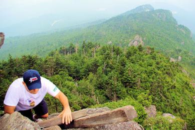
Grandfather Mountain
(1 to 12 miles, easy to strenuous) More than 12 miles of hiking trails range in difficulty from easy nature walks to strenuous backcountry challenges. Our favorite is taking the Grandfather Trail…
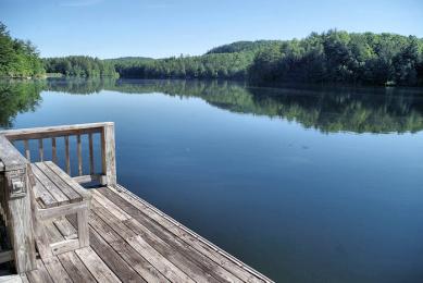
Lake James State Park
(.5 to 3.5 miles, easy to moderate). This state park with a beautiful lake has seven hiking trails and a beach for relaxing afterwards.
Sylva’s Pinnacle Park
(7 miles round-trip, strenuous) Hike to the top of The Pinnacle for views looking down into Sylva and the surrounding valley. Climb over 3,000 ft. in elevation with a steady grade.
Julian Price Park
(2.7 miles and 2.3 miles, easy) Hike around a beautiful lake or to the top of Green Knob. Blue Ridge Parkway Milepost 297.
Mt. Cammerer
(11.8 miles round-trip, strenuous) The hike up from Big Creek is a 5.9-mile constant climb with a gain of about 3,000 ft. in elevation. The stone fire tower on top affords fabulous views as your…
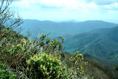
Richland Balsam
(1.5-mile loop, easy) Hike the top of the highest summit along the Blue Ridge Parkway in the cool forest. Blue Ridge Parkway Milepost 431.
Andrews Bald
(4 miles round-trip, moderate) At an elevation of 5,920 ft., this is the highest grassy bald in the Great Smoky Mountains. The hike near Clingmans Dome is not overly strenuous but includes a good…
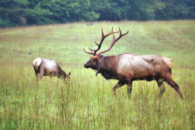
Cataloochee Valley Hiking
There are many hiking trails in beautiful Cataloochee Valley, home to the elk. A quick favorite is the one-mile Rough Fork Trail along the cascading stream.
Point Lookout Trail
(7.2 miles round-trip, moderate) The best paved greenway near Asheville is a blast for biking or hiking. This paved path in Pisgah National Forest was formerly part of Old US Highway 70, winding…
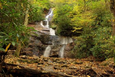
Daniel Ridge Falls
Located near Moore Cove Falls and Looking Glass Falls, this 150-foot cascade in Pisgah National Forest is also known as Tom's Spring Branch Falls. Accessed by an easy one-mile roundtrip hike. Or…
Mt. Mitchell Balsam Trail
(3/4 mile loop, easy) Take a loop hike through the dense, aromatic fir forest high atop on the summit of Mt. Mitchell. Great place for a cool walk on a hot summer day.
Waterrock Knob
(2.4 miles round-trip, strenuous) Hike to the summit (6,292 ft.) of the 16th highest mountain in the eastern United States. Blue Ridge Parkway Milepost 451.
Search Options Above
If you are searching for a day trip by region:
- Asheville
- East (Black Mountain, Chimney Rock, Morganton)
- North (Burnsville, Hot Springs, Madison City, Mt Mitchell)
- South (Brevard, Hendersonville, Saluda, Tryon)
- West (Bryson City, Cherokee, Highlands, Sylva, Waynesville)
- Great Smoky Mountains National Park (includes more options for the West)
- Blue Ridge Parkway (includes more options for North and West)
ADA Hiking Trails
Several area trails are designated as accessible according to the Americans with Disabilities Act (ADA), with parking lots and beginner trails. One is a 1/4-mile trail at the Folk Art Center on the Blue Ridge Parkway. Also, Mount Mitchell State Park has an ADA 1/4-mile paved trail to the observation tower, although it's uphill. See our Top 10 Accessible Paved Trails.
Additional
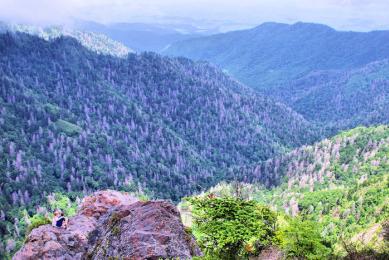
Hike the Highest Trails in the East
With more than 100 miles of public hiking trails, including the highest trails in the eastern United States, Burnsville has been called the Hiking Capital of Western North Carolina.
More Information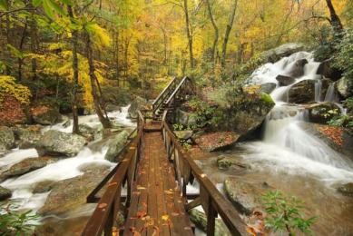
South Mountains State Park
(2-40 miles, easy, moderate, strenuous) This state park near Morganton has 40 miles of hiking trails. Our favorite is High Shoals Falls 2.7-mile loop trail to a beautiful 60-foot waterfall.…
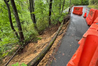
Chimney Rock State Park Reopens June 3 — Ahead of Schedule
A Memorial Day weekend landslide forced a brief closure at Chimney Rock at Chimney Rock State Park, but crews moved fast. The park reopens at 8:30 am on Wednesday, June 3. This is two days ahead…
The Blowing Rock
The Blowing Rock's dramatic views have been enjoyed from this cliffside perch since 1933 as North Carolina's oldest travel attraction. An immense cliff 4,000 feet above sea level, the Blowing…
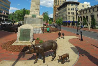
Asheville Urban Trail
(1.7-mile loop, easy) This outdoors museum is a self-guided walking tour on the sidewalks of downtown Asheville, leading to 30 sculptures that depict local history.
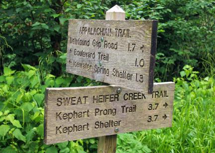
Appalachian Trail Day Hikes near Asheville
Take a "walk in the woods" in the most scenic sections of the 2,174-mile Appalachian Trail near Asheville, high in the North Carolina mountains. See our favorite six-day hikes for all fitness…