Limited-Time Offer: Save $50 on a Biltmore® Annual Pass
Buy Your Pass

Pink Beds has been a popular woodland hiking and picnic spot in the Pisgah National Forest for many years. Located four miles from the Blue Ridge Parkway on US 276 (Forest Heritage Scenic Byway), the five-mile loop hike has little elevation change, a rarity in North Carolina's higher mountains. So, it's perfect for all skill levels. The far section of the loop has some uphill sections with some roots and rocks to navigate. Just watch your step. Since there is plenty of shade, it's a great hike on hot summer days. On the Parkway, there is an overlook of this area at Milepost 410.
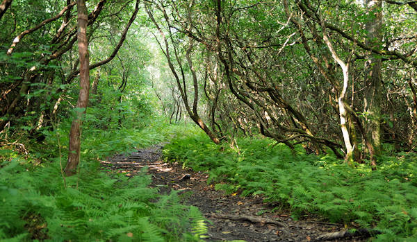
This hike is especially appealing to naturalists since the valley has some very large pine trees and rare mountain bogs. The trail takes you through a variety of forest types, including through twisting rhododendron with ferns covering the ground. The Pink Beds Valley was named by the settlers who first cleared the area when the abundant blooms of summer rhododendron and mountain laurel were visible from the surrounding mountainsides. Since the valley has been reforested, it's more green than pink. For more history on forestry, stop next door at the Cradle of Forestry Discovery Center.
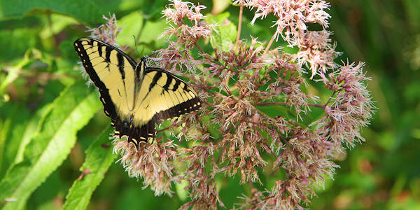
The wealth of summer wildflowers makes it a haven for butterflys, bees and hummingbirds. With an elevation of around 3,200 ft., the Pink Beds has a series of boardwalks (finished in 2012) above a recently flooded area thanks to a beaver dam. This rare highland bog is home to many rare plants and insects. Bring your mosquito repellant in the summer months! A great spot for night strolls to see fireflies, especially in June.
To begin the hike, look for the large sign board near the picnic area. The trail is an old road, so it's easy to follow. Shortly after you begin, you will cross a creek (great for a foot soak at the end of your hike) and the two-way option for the loop trail. If you want to just see the boardwalks, they are about 3/4 of a mile to the right. About a mile down the trail, you will intersect Barnett Branch Trail and South Fork Bridge for another walk through a wetland teeming with flowers, birds and butterflies. To the right, the trail cuts through the middle of the loop so you can cut the hike in half.
The picnic area has 21 tables and two shelters for groups, located adjacent to a big parking area. There is $50 charge if you want to reserve a shelter on a busy day (call 828-877-3265). There's no charge to enjoy the picnic area or trail.
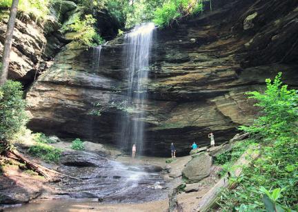
Nearby are Looking Glass Falls, Sliding Rock and great hikes to Looking Glass Rock and John Rock. See our Pisgah Forest Waterfall & Hiking Map.
Directions from Downtown Asheville (about 36 miles): Take I-240 West / I-26 East. Continue on I-26 East to Exit 40 for Highway 280 (and the Asheville Airport). Take a right onto Highway 280 West and go 16 miles toward Brevard. As you enter the Brevard area, you will see a big shopping center on the right (with Wal-Mart). Just past the center, turn right onto US Highway 276 North (Forest Heritage Scenic Byway) to enter the Pisgah National Forest. Go about 11 miles and watch for sign on the right.
Directions from Blue Ridge Parkway: Take exit for Highway 276 (milepost 412). Take 276 South for four miles and look for the picnic area entrance on the left.