Explore a lesser known area of DuPont State Recreational Forest with this four-mile roundtrip hike with gentle rolling hills. Hike wooded trails to beautiful secluded lakes (including Lake Julia in photo above) and a surprise airstrip with a great mountain view. Get away from the crowds at nearby High and Triple Falls. Park at the Fawn Lake parking area with a big network of signed trails. It's also a great spot for beginner mountain biking since most trails are wide and gentle.
This quieter side of the forest is primitive, so there are no restrooms or visitor center. Bring water and snacks. Find portable toilets at the Fawn Lake parking area.
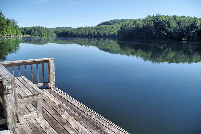
Our first stop is beautiful Fawn Lake, a small reservoir with a small floating dock as of Fall 2024. From the parking area, go left on Fawn Lake Road about a half mile. This road is closed to motor vehicles other than those associated with the Forest Service. The lake is a very popular swimming hole on hot summer days. Other times of the year, you often have it all to yourself. Take a break at the lake to enjoy the reflection of the mountain ridge in the water. There is a grassy area great for picnics and a zero entry into the lake, perfect for families with young children.
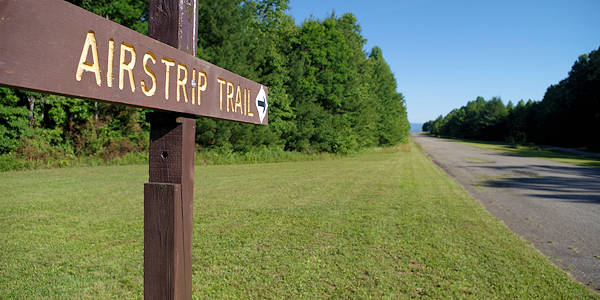
The next stop is the paved airstrip hidden in the middle of the forest. From Fawn Lake, continue on the road across the earthen dam for about a half mile to Conservation Road. Turn left and you'll soon arrive at the airstrip at "The Summit", elevation 2,800 feet. It was built by a previous owner in 1970s and later used by DuPont executives when they purchased the land for their plant. Today, it's only used for occasional training for the Forest Service pilots and military helicopters. To your left, you'll notice a mountain vista at the end of the half-mile runway. In the summer enjoy wildflowers on each side of the Airstrip Trail.
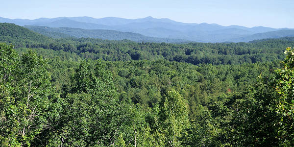
Walk to the end of the airstrip to see this panoramic mountain view centered on Mt. Pisgah.
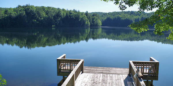
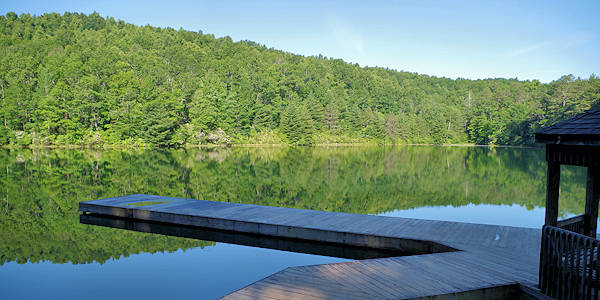
Next stop is Lake Julia! From the end of the runway, turnaround and walk back to the trail crossing. Turn left onto Conservation Road. Walk about a third of a mile downhill to Lake Julia Road on the right. You'll see a cabin in the woods nearby. Several of the homes built prior to the area becoming a state forest are now used for housing for forest staff. Turn right on Lake Julia Road about a third of a mile to the main forest office on the left (a former lodge). While the office is not open to the public, find some stairs that take you down to an idyllic spot on a pier on Lake Julia. Only a very small percentage of DuPont visitors ever see this pristine 100-acre lake.
After you pull yourself away from the lakeside, return to the Lake Julia Road and go left to the intersection of Camp Summit Road on the right. You can take short detour down Lake Julia Road for a lakeside picnic area. The lakeside picnic area. This area is perfect for swimming and picnicking! There's a big grassy area with picnic tables, bike racks, horse tie-outs, and room for plenty for folks. There's also zero-entry access to the lake. This is the best spot on Lake Julia to swim. Or go right to head back to the parking area. The Camp Summit Road Trail is an half-mile trail back to the airstrip. From the airstrip, continue straight across back onto Conservation Road. Then you can either return the same way you hiked in via Fawn Lake Road or continue on Conservation Road back to the parking area.
Bridal Veil Falls: It's a 2.3-mile hike (so 4.6 miles roundtrip) to one of the biggest waterfalls at DuPont. For the most direct route from the Fawn Lake Access Area, turn right on Fawn Lake Trail for a tenth of a mile. Then turn left onto Conservation Road for 1.7 miles past the airstrip. Turn left on Bridal Veil Falls Road an half mile to the waterfall. Read more. (Conservation Road continues to the High Falls covered bridge and parking area.)
Epic Hike: Combine this hike with our DuPont 7-mile waterfall hike for a 12-mile expedition! The two hikes are only separated by a third of a mile via Conservation Road. A great mountain bike ride.
Download a PDF of the DuPont Forest Trails Map. Save it to your phone before your go. 4 MB.
Fawn Lake Access Area Driving Directions
From Asheville: I-26 East to exit 40 for Highway 280/Airport exit toward Brevard. Turn right onto 280 and drive about 16 miles. Turn left on U.S. 64 as you enter Brevard past Wal-Mart. Travel east on U.S. 64 for 3.7 miles to the gas station in Penrose. Turn right on Crab Creek Rd and continue 4.3 miles and turn right on DuPont Rd. Go to the end of DuPont Road (that becomes Staton Road) in 5.3 miles. You'll pass the Hooker Falls and High Falls parking areas. At the end of Staton Road, turn left onto Cascade Lake Road. Go 2.5 miles, turn left Reasonover Road. Fawn Lake parking is 2.8 miles on left. (Google Map below)
From Downtown Brevard: Take US 276 South 11 miles to Cedar Rock community. Turn left on Cascade Lake Road and immediately turn right onto Reasonover Road for 2.8 miles.
Hiking Trail Map
#23 Fawn Lake | #18 Conservation Road | #1 Airstrip Trail | #42 Lake Julia Road | #12 Camp Summit Road