Win a Winter Lights Package!
Enter to win a free pass to the spectacular outdoor light show at The North Carolina Arboretum in Asheville and more.
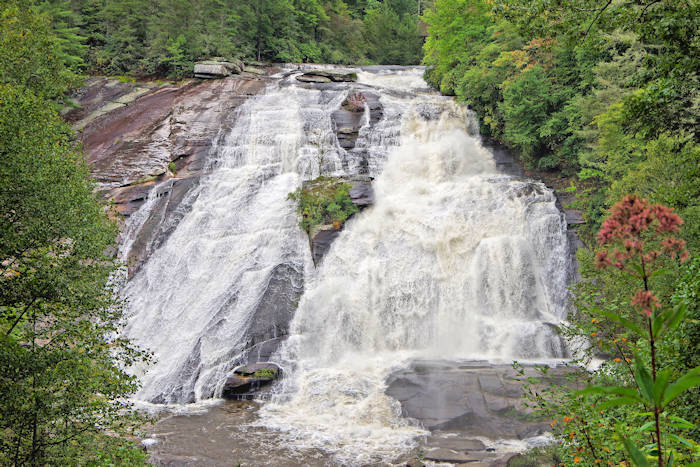
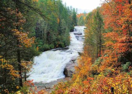
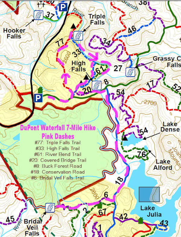
See three of our biggest waterfalls (Triple Falls, High Falls and Bridal Veil Falls), Lake Julia, and beautiful woodlands along the way in DuPont State Recreational Forest with a 7-mile hike from the High Falls parking area and Visitor Center. Take plenty of water and some snacks. And check with the volunteer in the Visitor Center for a map and advice. We created this hike by combining several trails, ending your journey back at the starting point. See a map of the trails at the bottom of this page. It's a moderate hike with a few hills but nothing overly strenuous. (Pic at the top is above High Falls.)
Start your hike on High Falls Loop from the parking area. After about a half-mile, turn left on High Falls Loop to reach Triple Falls first.
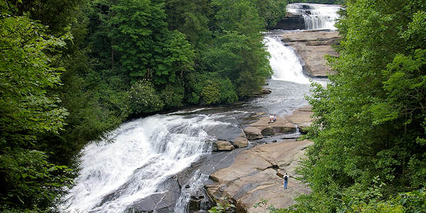
Mile 1.1: See all three cascades of Triple Falls from the main trail. Then backtrack just a bit to the staircase that takes you down for a closer look. Read more about Triple Falls.
Mile 1.3: After going down the stairs, find a wide rock plateau by the cascades, a great place to soak in the view and sound. Stay out of the water since currents are strong and you are at the top of the bottom cascade. Remember to stay behind the cable barricade.
Mile 1.9: At the top of the Triple Falls stairs, turn left and head to the High Falls Trail.
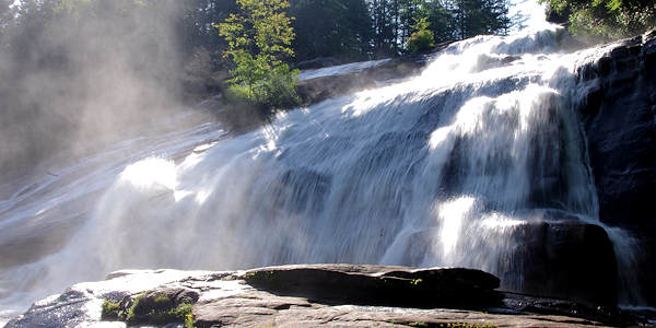
Mile 2.2: Before you reach High Falls, you can take an optional detour on the "Base of Falls" trail. This adds about a half-mile roundtrip, taking you along the river for a close-up view. Or continue straight to see High Falls from the trail (pic at very top of page). Read more about High Falls. Continue 2/10-mile to the Covered Bridge Trail.
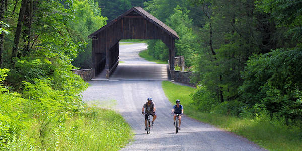
Mile 3.0: The Covered Bridge Trail takes you to Buck Forest Road. The roads within DuPont State Recreational Forest are for forest service vehicles only. Turn left and walk across the covered bridge at the top of High Falls. A short distance past the bridge, turn right onto Conservation Road (you'll see a sign that says "Bridal Veil Falls 1.6 miles"). Both Buck Forest Road and Conservation Road are also great for beginner mountain biking.
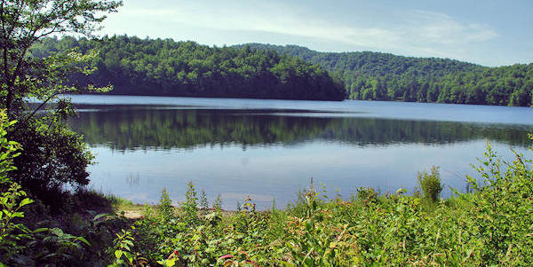
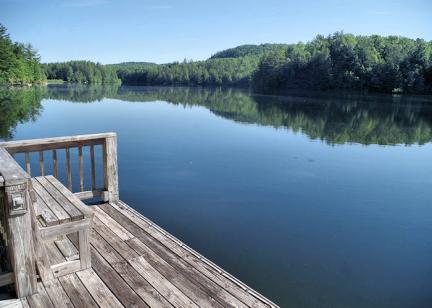
Mile 3.75: After you cross a bridge over the Lake Julia spillway, you'll see a short trail on the left that takes you to the top of the dam for this view of the lake. Return to the main trail and turn left to proceed to Bridal Veil.
Mile 4.7: After walking 1.1 miles on Conservation Road, turn right onto Bridal Veil Falls Road. Pass a stable on the left. At the end of the trail, you'll find a wide turnaround area with a more narrow trail that leads to the base of the broad waterfall. Read more about Bridal Veil Falls.
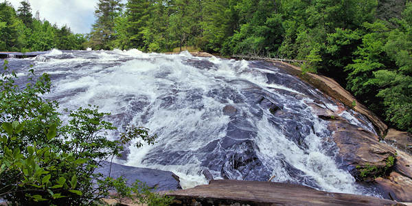
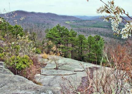
Mile 4.9: Enjoy the views from an observation deck or multiple rocky spots below the falls. Do not climb the rock face beside the waterfall - it is now off limits due to too many injuries. After you rest and enjoy the view, head back via the same route to the parking area.
Mile 7.1: Arrive back at the Visitor Center via Bridal Veil Falls Road, taking a left on Conservation Road and another left at the end onto Buck Forest Road.
If you want to extend your hike by 1.5 miles, from Triple Falls continue to Hooker Falls and return the same way. Read more about Hooker Falls.
Extend your hike by 5 miles by combining our DuPont Hike to Hidden Lakes.
Most of the trail to Bridal Veil Falls follows an unpaved road closed to cars, so it's great for biking.
Download a PDF of the DuPont Forest Trails Map. Save it to your phone before your go. 4 MB.
DuPont State Forest Directions from Asheville
Take I-26 East to exit 40 for Highway 280/Airport exit toward Brevard. Turn right onto 280 and drive about 16 miles. Turn left on U.S. 64 as you enter Brevard past Wal-Mart. Travel east on U.S. 64 for 3.7 miles to the gas station in Penrose. Turn right on Crab Creek Rd and continue 4.3 miles and turn right on DuPont Rd. Ascend and descend; after 4.2 miles, find High Falls parking area on the left. (Street address: 89 Buck Forest Road, Cedar Mountain, NC 28718)
