Limited-Time Offer: Save $50 on a Biltmore® Annual Pass
Buy Your Pass

Hike to the top of The Pinnacle (elevation 5,008 feet) near Sylva for panoramic views of the valley in Jackson County. The steady uphill hike of 3.4 miles one way climbs 3,000 feet in elevation, following an old logging road for much of the way. The 1,400 acre park is owned by the town and operated by the Pinnacle Park Foundation.
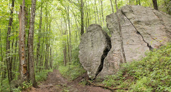
The entire hike follows the West Fork Trail that starts at the back of the parking lot at an iron gate. About a half mile into the hike, you'll pass the huge split rock. Shortly after that, stop for a cascading water of Fisher Creek. Wear sturdy hiking shoes for the rocky, uneven sections of the trail.
About two miles into the hike, your take a left and arrive in on open grassy ridge with some campsites at about mile three. Look the narrow trail to continue through the rhododendron to the Pinnacle summit.
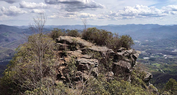
Walk onto the pinnacle for the panoramic views. Of course, we careful of the sharp drop offs! It's a favorite hike for students at nearby Western Carolina University.
Since downtown Sylva is only 10 minutes away, it's a great place for dinner. Or sample local beers at three breweries. Read more about Sylva. Photos by local Nick Breedlove.
Directions from Asheville (about 48 miles): Take I-40 West to Exit 27 and follow US 74 West to Sylva. When you reach the edge of Sylva, turn right on Steeple Road. Go about 1/3 mile and turn left onto Skyland Drive. Go half mile and turn right onto Fisher Creek for about 2.5 miles.

