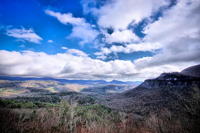
A landmark in the Nantahala National Forest, Whiteside Mountain rises to an elevation of 4,930 feet. It's located between Cashiers and Highlands, North Carolina, on US Highway 64. The mountain’s cliffs look like sheets of ice draped across the mountain. Geologists believe Whiteside to be one of the oldest mountains in the world at 360 to 490 million years old. A "moderate" two-mile loop trail takes you on top of sheer 750-ft. high cliffs (plenty of railings for safety) with outstanding views to the east, south and west. Along your journey to the top, you can spot a variety of wildflowers—including false Solomons seal, white snakeroot, dwarf dandelion, speckled wood-lily and wood betony.
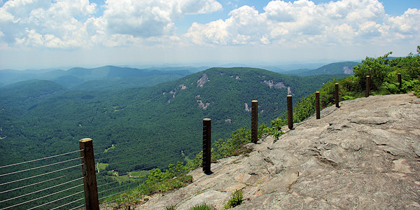
The two-mile hike begins as an old logger trail that was also once used as a road for a shuttle bus that would carry people up to the top of the lookout point. Follow this road uphill about a mile to the top. At the top, you will see the first of several overlooks breathtaking vistas. The trail continues about a 1/2-mile along the ridge of the mountain, plenty of places to enjoy the views from the rock face. There are quite a few "educational" signs along the way to add interest. Be sure to read about the daring 1911 rescue by Charles Wright at Fool's Rock. Toward the end of the walk along the mountaintop, look for the highest point with the rock-carved "Alt. 4,930 ft." The last 1/2-mile of the trail is a steep downhill section that leads you back to the logging road near the parking area.
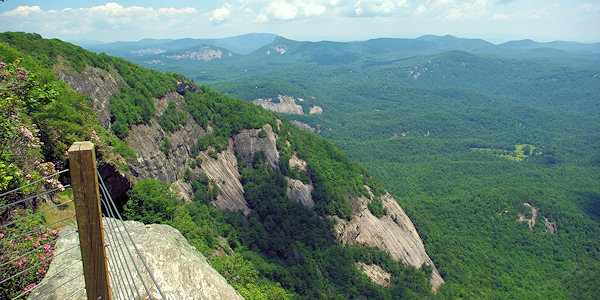
Top of Whiteside Mountain at "Fool's Rock."
During the spring and summer, you may see peregrine falcons flying above or sitting on rock outcrops. Through the endangered species program, the falcon was reintroduced in 1985 to Whiteside Mountain, part of the bird’s native range. From January until summer, peregrines—one of the world’s fastest and most beautiful birds— return annually to nest on rock ledges. Because peregrines are nervous parents, climbing routes near nesting sites are closed during nesting. Please see maps on display at the parking lot for current closures.
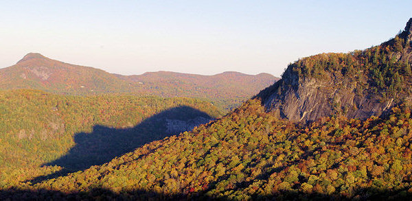
See the Shadow of Bear from the Rhodes Big View overlook on US 64.
Millions of years ago and before North America existed, Whiteside Mountain began as a huge mass of molten rock deep in the earth. The rock cooled, and then heat, pressure and uplifting metamorphosed the granite rock into a granitic gneiss (pronounced “nice”). In the following ages, the overlying material eroded to expose this majestic rock. You can best see the solid rock foundation of this mountain on the south-facing cliffs, where wind and drier conditions limit plant growth. White streaks of quartz and feldspar line the face.
Directions From Asheville
(53 miles - allow 1.5 hours to drive the curvy roads).
Take I-26E to exit 40 (Asheville Airport). Turn right on NC 280W. NC 280W becomes US Highway 64W in Pisgah Forest. Stay on U.S. 64W through Cashiers, and go another five miles. Turn left on SR 1600 at Whiteside Mountain sign. Turn left into Whiteside Mountain entrance. Parking is $2 per car, pay on the honor system.
See hikes to nearby waterfalls. And see Jackson County things to do.
