Limited-Time Offer: Save $50 on a Biltmore® Annual Pass
Buy Your Pass

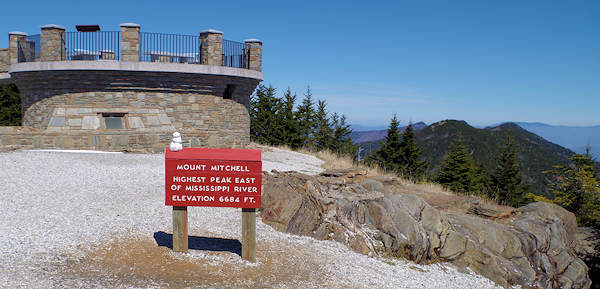
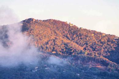
Highest Mountain in Eastern USA: Mt. Mitchell
Since you can drive almost to the top of highest summit east of the Mississippi, it's just a short walk (but uphill) on a paved trail to the observation deck. Mt. Mitchell State Park (free admission and located off the Parkway) is a must-see for anyone looking for elevation! The Deep Gap Trail starts from the summit parking lot and takes you to Mt. Craig, the second highest peak in the eastern USA. It has great views from it's summit also. Read more about Deep Gap Trail.
More Suggestions for Views
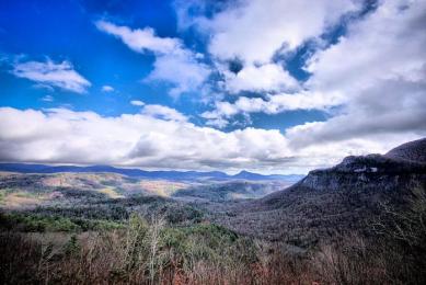
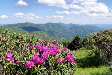
The many overlooks along the Blue Ridge Parkway offers panoramic mountain views roadside. So it's a great alternative for those that cannot hike or if you have small children. See our Blue Ridge Parkway guide.
More Hikes: See our Top 75 Hikes Near Asheville!
Google Map of These Hikes
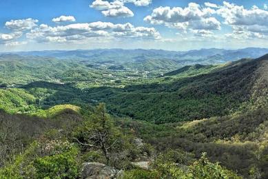
Best Mountaintop Hikes near Asheville

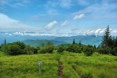
Black Balsam Knob
(1-10 miles, moderate) For sweeping 360-degree views, hike across these bald mountaintops. Almost entirely devoid of trees above 6,000 ft., the summit is more reminiscent of New England than North…
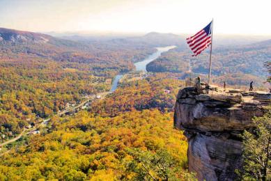
Chimney Rock Park Hikes
(1 to 4 miles, easy to strenuous) Hike a variety of trails with spectacular views of Hickory Nut Gorge or a 400-foot waterfall. Often overlooked, the challenging Four Seasons Trail begins near the…
Looking Glass Rock
(6.5 miles roundtrip, strenuous) For 180+ degree views from a rock face, hike to the top of this iconic summit in the Pisgah National Forest. You'll hike the "backside" of the mountain, gaining 1,…
Rough Ridge
(1.5 to 8 miles round-trip, moderate to strenuous) This unique hike offers plenty of breathtaking viewpoints and a wooden boardwalk over fragile vegetation. The Tanawha Trail features many rock…
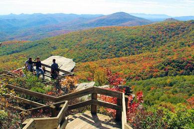
Devil's Courthouse
(1 mile round-trip, moderate) This short-but-steep trail climbs a half-mile to the peak for spectacular views. The bare rock profile named Devil's Courthouse is sinister in appearance and legend.…
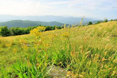
Huckleberry Knob
(2.5 miles roundtrip, easy) Located along the very scenic Cherohala Skyway, this 5,560-foot bald summit has 360-degree views of the Nantahala National Forest. Near Robbinsville.
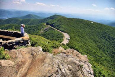
Craggy Pinnacle
[CURRENTLY CLOSED] (1.4 miles round-trip, strenuous) For our favorite 360-degree mountain view along the Blue Ridge Parkway, hike to the top of this 5,892-ft. peak at Craggy Gardens. Trailhead at…
Beech Mountain Hikes
(1 to 20 miles, easy to strenuous) The Town of Beech Mountain, the highest town in eastern America, has 20 miles of maintained trails atop their mountain. A great place to keep cool since their…
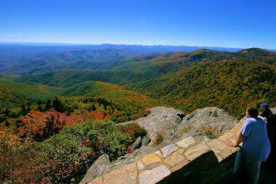
Whiteside Mountain
(2-mile loop hike, moderate) A landmark in the Nantahala National Forest, located between Cashiers and Highlands, Whiteside rises to an elevation of 4,930 ft.. A loop trail takes you to…
Max Patch on Appalachian Trail
(1.4 or 2.4 miles, moderate) Hike a section of the famous Appalachian National Scenic Trail (or AT) near Hot Springs. What a picnic spot with 360-degree mountain views! The 1.4-mile short loop…
Cedar Rock Mountain, DuPont Forest
(4.5 miles loop, moderate) This hike provides wonderful views and dramatic scenery - and it's not difficult. Rising only a few hundred feet above the surrounding plateau, walk across areas of…
Sylva’s Pinnacle Park
(7 miles round-trip, strenuous) Hike to the top of The Pinnacle for views looking down into Sylva and the surrounding valley. Climb over 3,000 ft. in elevation with a steady grade.
Bearwallow Mountain
(1 mile roundtrip, moderate) Near Chimney Rock, hike to the summit of this bald mountain with wonderful views. It's an easy drive from downtown Asheville!
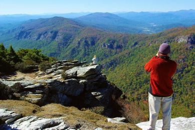
Hawksbill Mountain
(1.5 miles round-trip, moderate) Enjoy spectacular mountaintop views overlooking Linville Gorge. We love to hike this and nearby Table Rock on the same day! Take a picnic.
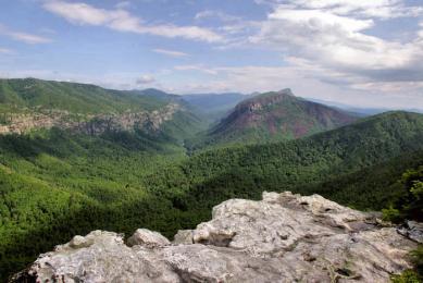
Shortoff Mountain
(4.5 miles round-trip, strenuous) Located near Lake James, a beauty of a hike to the top of a plateau summit with spectacular views of Linville Gorge.
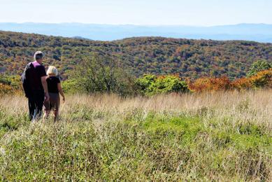
Andrews Bald
(4 miles round-trip, moderate) At an elevation of 5,920 ft., this is the highest grassy bald in the Great Smoky Mountains. The hike near Clingmans Dome is not overly strenuous but includes a good…
Roan Mountain Appalachian Trail
Note: Roan Mountain Recreation Area will be closed during repairs for the 2024 season. The area to be closed includes the rhododendron gardens, Roan High Bluff, Cloudland parking area,…
Mt. LeConte & Alum Cave
(11 miles round-trip, strenuous) The Alum Cave Trail is the most-hiked in the Great Smoky Mountains. You'll see why, with interesting geological features and stunning views. To reach the 6,593-ft…
Table Rock Mountain
(2.2 miles round-trip, moderate) Hike to the top of one of the most recognized peaks in the Blue Ridge Mountains. This trailhead is just five miles from Hawksbill, so you can double your fun.
Highest Mountain in Eastern USA: Mt. Mitchell
Since you can drive almost to the top of highest summit east of the Mississippi, it's just a short walk (but uphill) on a paved trail to the observation deck. Mt. Mitchell State Park (free admission and located off the Parkway) is a must-see for anyone looking for elevation! The Deep Gap Trail starts from the summit parking lot and takes you to Mt. Craig, the second highest peak in the eastern USA. It has great views from it's summit also. Read more about Deep Gap Trail.
More Suggestions for Views
The many overlooks along the Blue Ridge Parkway offers panoramic mountain views roadside. So it's a great alternative for those that cannot hike or if you have small children. See our Blue Ridge Parkway guide.
More Hikes: See our Top 75 Hikes Near Asheville!


