Limited-Time Offer: Save $50 on a Biltmore® Annual Pass
Buy Your Pass

The 3.6-mile Laurel River Trail in Pisgah National Forest (trail #310) near Hot Springs is definitely one of the flattest hikes in our mountains, yet it delivers plenty of mountain scenery along the way. It is a delight for those of us that love the sound of river rapids and lush mountain woodlands. You will find many spots to access the Big Laurel Creek and take a swim. Fishing and mountain biking is allowed, too.
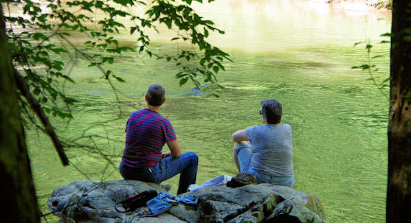
The many boulders along the banks make perfect picnic spots. The roundtrip of 7.2 miles is perfect for all seasons. The trail is beautiful in early spring with wildflowers blooming along the trail and river’s edge. The trail is a true winter wonderful thanks to frozen waterfalls. The trail begins at the intersection of US 25 and NC 208; see directions below.
There’s a large roadside parking area on your left just before the intersection. The trail begins to the far left with “private property” signs, since the trail follows a unpaved road for about a mile before you enter Pisgah National Forest. The trail narrows and becomes more scenic as you stroll by the Big Laurel Creek all the way to the French Broad River. It also becomes more rocky and uneven with tree roots, but there are no steep sections.
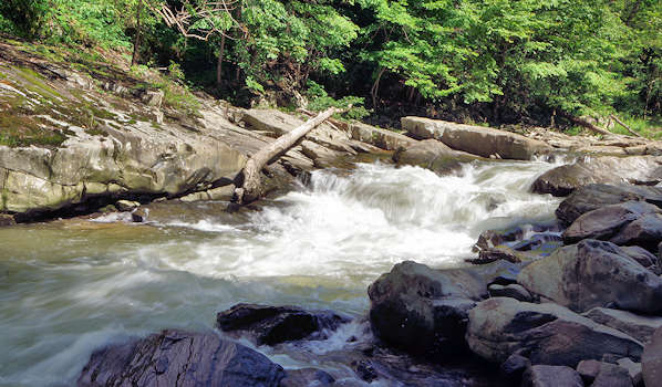
The rock cliffs along the creek amplify the sounds of the rushing water in many sections. Pets are allowed on a leash. The trail follows the site of old railroad line that carry logs to the Runion sawmill in the 1920s, ending at the “ghost town” of Runion with foundations and chimneys.
There are no public bathroom facilities. The Laurel River Store, visible from the trail parking area, has restrooms for customers. Downtown Hot Springs is a five-mile drive north (follow the signs).
Driving Directions
From Asheville, it's about 31 miles. From downtown, take I-26 West / US 19 N / US 23 N / US 70 W toward Weaverville. Take exit 19A for US 25 N / US 70 W toward Marshall. Go 21.3 miles until the NC 208 intersection (US 25 / 70 turns left). Before the turn, see the large parking area on the left. For GPS, you can use the nearby Laurel River Store (on other side of the river past the parking area): 5150 US-25, Marshall.
Nearby
Continue on US 25 / 70 for five miles to reach the town of Hot Springs - see our insider's guide for things to do there. About 2.8 miles en route to Hot Springs, you'll cross the Appalachian Trail and road to Rich Mountain Lookout Tower. On the way back, take a small detour to explore downtown Marshall (read more). Also see our Madison County Guide.

