
Find the best waterfalls along the Blue Ridge Parkway in North Carolina near Asheville, either directly on the Parkway or within a 10-mile detour. All are free to visit, but most are a bit hidden since they are not signed or found via maps or GPS. So, see our full guides for each by clicking on the listings below. The photo above is Linville Falls.
Stops along the Blue Ridge Parkway are measured by mileposts (MPs). Here's a route to follow to see all 10, from north to south, with full listings below:
- MP 316.3: Linville Falls with hikes to four vistas.
- MP 339.5: Crabtree Falls via 3-mile roundtrip hike.
- MP 344: Detour on NC Highway 80 for Roaring Fork Falls and Setrock Creek Falls.
- MP 362.1: Glassmine Falls, viewed from the overlook.
- MP 412: Detour south on US Highway 276 to Log Hollow Falls (6.2 miles) and Looking Glass Falls (10 miles).
- MP 418.8: Short hike to Second Falls at Graveyard Fields.
- MP 423.3: Exit on NC Highway 215 for 4.6 miles to Dill Falls.
- MP 455.7: Go one mile on U.S. Highway 19 for Soco Falls near Cherokee.
Top 10 Parkway Waterfalls in NC, North to South
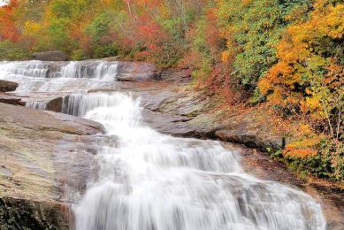
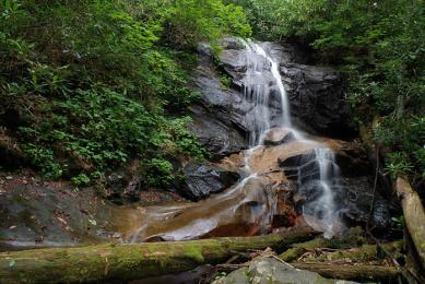
Graveyard Fields Waterfalls
This popular hiking area on the Blue Ridge Parkway has two waterfalls. Second Falls (in pic) is just 1/3-mile walk from the Parkway. Upper Falls is on a four-mile loop trail in the mile-high…
Soco Falls
This rare twin waterfall is located roadside near Maggie Valley and Cherokee. You can easily miss it since there are few signs! The observation deck and viewing platform is a short walk from a…
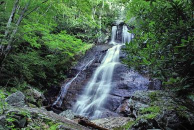
Roaring Fork Falls
Located just two miles from the Blue Ridge Parkway (exit near Milepost 344) and five miles from Crabtree Falls in Pisgah National Forest at the base of Mt. Mitchell. It's an easy one-mile round-…
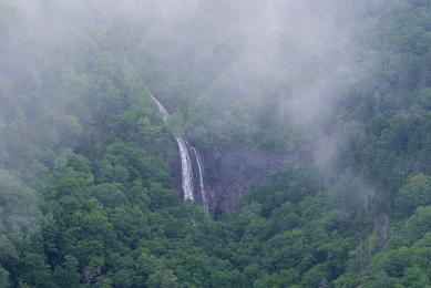
Glassmine Falls
This skinny waterfall on Blue Ridge Parkway Milepost 362 is visible from an overlook. Falling along a cliff across the valley, it's most visible after heavy rains and with leaves are off the trees…
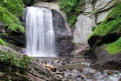
Looking Glass Falls
Roadside 60-ft. waterfall in Pisgah National Forest along the Forest Heritage Scenic Byway. Enjoy from the parking area or take the steps down for an up-close look. 10 miles from Blue Ridge…
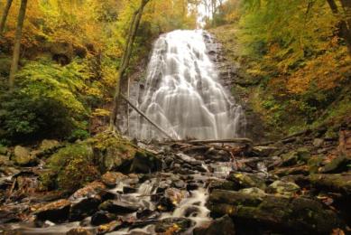
Crabtree Falls
(3 miles round-trip, moderate) This gorgeous 70-ft. waterfall along the Blue Ridge Parkway (Milepost 339), near Linville Falls, is accessed by a very scenic, loop woodland hiking trail.
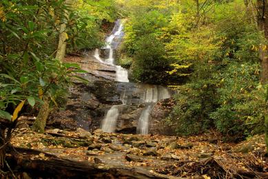
Setrock Creek Falls
Located a few miles from the Blue Ridge Parkway (exit at Milepost 344) on NC Highway 80, a 1/2-mile hike takes you to this 75-ft. waterfall. Nearby is Roaring Fork Falls.
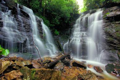
Dill Falls and Upper Dill Falls
(1 mile round-trip, easy) Hike to two waterfalls, Upper and Lower Dill Falls, via easy walks from the end of a forest service road deep in Nantahala National Forest. 4.6 miles from the Blue Ridge…
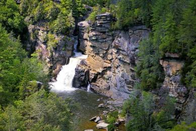
Linville Falls
Perhaps the most photographed waterfall in NC, Linville Falls (a.k.a. the “Grand Canyon of the Southern Appalachians”) is along the Blue Ridge Parkway (Milepost 316). A moderate hike of…
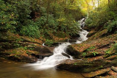
Log Hollow Falls
(1 mile round-trip, easy) Located near Looking Glass Falls, this 25-ft. waterfall is often missed since it's off the beaten path in Pisgah National Forest.
For more information about planning a trip, go to our Blue Ridge Parkway Guide.


