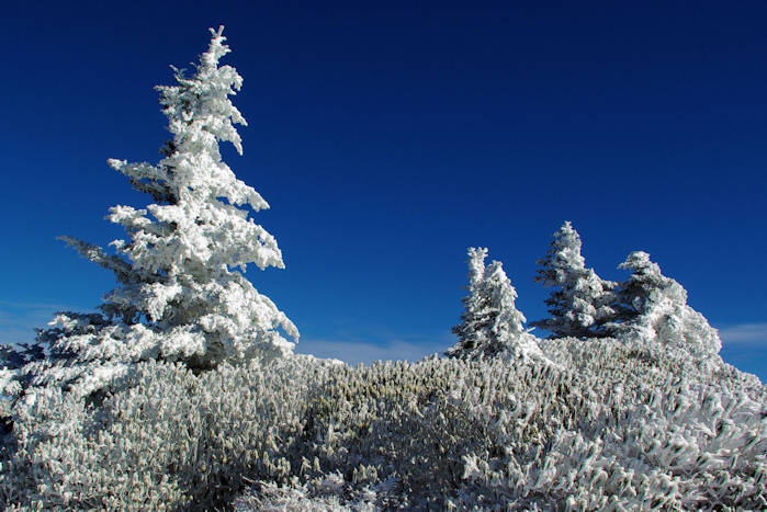
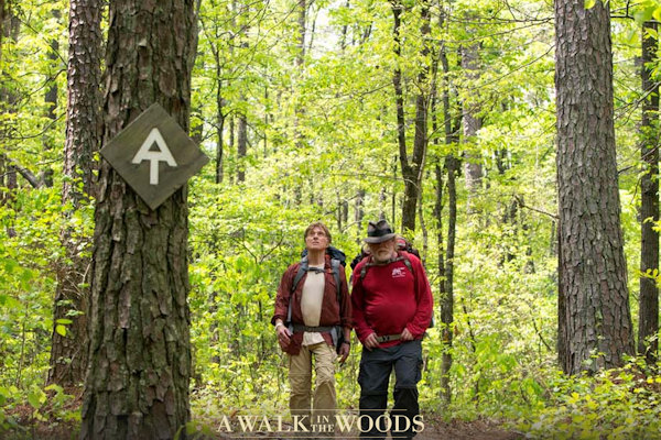
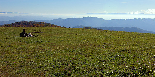
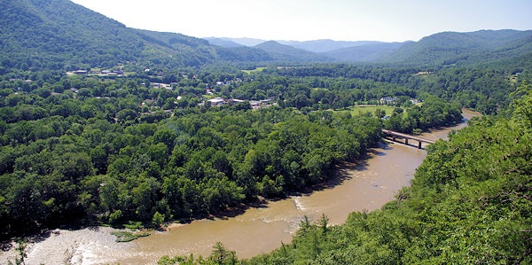
The Appalachian National Scenic Trail (AT) is a 2,174-mile footpath along the ridgecrests and across the major valleys of the Appalachian Mountains. Featured in the movie A Walk in the Woods, the trail traverses Maine, New Hampshire, Vermont, Massachusetts, Connecticut, New York, New Jersey, Pennsylvania, Maryland, West Virginia, Virginia, Tennessee, North Carolina and Georgia. The Appalachian Trail is used by day, weekend and other short-term hikers, section-hikers and thru-hikers. Thru-hikers hike the entire length of the Trail in one season. There are many opportunities for shorter hikes on the AT near Asheville. (Pic above is Roan Mountain.)
6 Day Hikes on the Appalachian Trail near Asheville NC
1. Max Patch: Hike across the grassy summit with 360-degree mountain views all around! You can visit for a picnic or take a all-day trek up the trail. See our Max Patch Guide.
2. Roan Mountain: The AT crosses several balds here, so you have plenty of spectacular views along the way. Winters are harsh but great for a snowy hike. Summers bring many blooming rhododendron. See our Roan Mountain Guide.
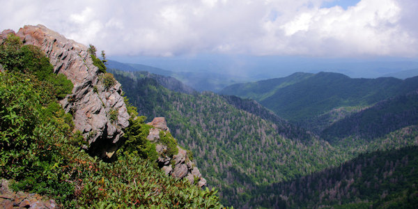
3. Great Smoky Mountains: Hike north from Newfound Gap to Charlies Bunion for a high-altitude 8-mile round-trip trek through a lush forest, ending at a rocky cliff with one of the best views in the Smokies. See our Charlies Bunion Guide. Or hike south for 7.5 miles to Clingmans Dome, the highest peak on the AT (if you have two cars, this is a great option for a one-way hike since there is parking at both ends).
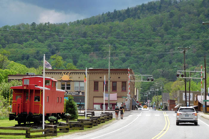
4. Hot Springs: The AT goes right down Main Street in the town of Hot Springs. From downtown, hike to Lover's Leap for a grand overlook across the French Broad River. Also, hike to the fire tower on Rich Mountain. Bluff Mountain Outfitters offers shuttle services to various points on the AT for a one-way hike back to town.
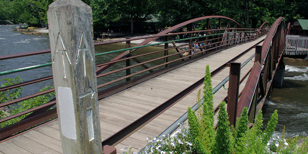
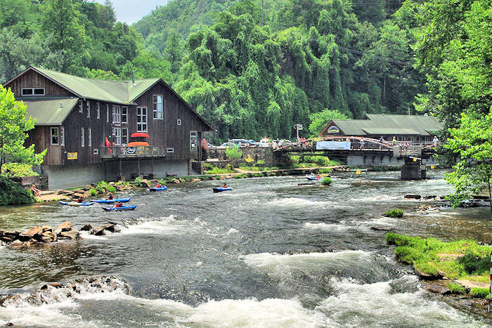
5. Nantahala National Forest: Hike to Wesser Bald Lookout Tower or Wayah Bald Lookout Tower. Have lunch along the Appalachian Trail at NOC on the Nantahala River (pic), the whitewater rafting mecca.
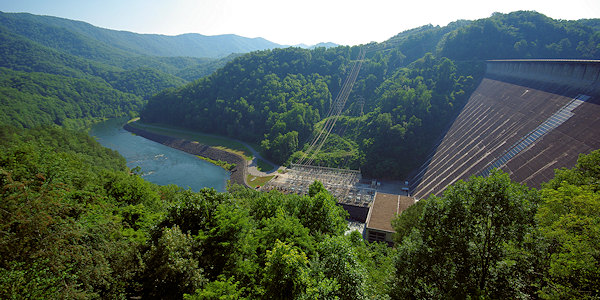
6. Fontana Dam: Hike the Appalachian Trail north across the tallest dam in eastern America into the Great Smoky Mountains National Park. This is the start of the 71.6-mile section through the rugged Smokies. If you are looking for a long weekend of backpacking, you can hike 40.6 miles to Newfound Gap (the next highway crossing). The Visitor Center has showers for hikers, and the nearby Fontana Shelter is often called the "Fontana Hilton" since it sleeps 24 and has a restroom and water. It's a rare treat along the AT. Or, hike 15 miles south to Stecoah Gap at NC Highway 143. As featured in the movie A Walk in the Woods (read more)!
Appalachian Trail Resources
Safety
See our Waterfall & Hiking Safety Tips before you hit the trail.
Frequently Asked Questions
Provided by the Appalachian Trail Conservancy.
How is the Trail marked?
The Appalachian Trail is marked for daylight travel in both directions, using a system of two-inch by six-inch paint "blazes" on trees, posts and rocks. There are some local variations, but most hikers grasp the system quickly. Above treeline, and where snow or fog may obscure paint marks, posts and rock piles called "cairns" are used to identify the route. White-paint blazes mark the AT itself. Side trails and shelter trails use blue blazes; blazes of other colors and shapes mark other intersecting trails. Two white blazes, one above the other, signal an obscure turn, route change, incoming side trail or other situation that requires you to be especially alert to changes in direction. In some states, one of the two blazes will be offset in the direction of the turn.
Where can I get maps?
The Appalachian Trail Conservancy and its member clubs publish the official guidebooks and maps for the Appalachian Trail, available for purchase online at the Ultimate AT Store or by phone at 1-888-AT STORE.
Do I need a permit?
The Appalachian Trail is open for all to enjoy. No fees, memberships or paid permits are required for walking on the Trail. However, the AT passes through numerous state and national parks, forests and public lands, a few of which require permits, fees or reservations to stay overnight in shelters or campsites.
Where can I camp?
More than 250 backcountry shelters are located along the Appalachian Trail at varying intervals, as a service to all AT users. A typical shelter, sometimes called a “lean-to,” has a shingled or metal roof, a wooden floor, three walls and is open to the elements on one side. Most are near a creek or spring, and many have a privy nearby. Hikers occupy them on a first-come, first-served basis until the shelter is full. They are intended for individual hikers, not big groups. If you're planning a group hike, plan to camp out or to yield space to individual hikers who may not have the resources you do. Many shelters are near good campsites for tenting.
Where are the restrooms?
Few and far between. Many AT shelters have privies, but often you will need to "go in the woods." Proper disposal of human (and pet) waste is not only a courtesy to other hikers, but is a vital Leave No Trace practice for maintaining healthy water supplies in the backcountry and an enjoyable hiking experience for others.
Can I bring my dog?
Dogs are permitted along most of the Trail, but they impose additional responsibilities on hikers who bring them along. If you want to hike with your dog, be considerate of others (and your dog) by planning carefully, educating yourself about local regulations and keeping your dog controlled at all times. Dogs are not allowed in the Great Smoky Mountains National Park in Tennessee and North Carolina, Baxter State Park in Maine, and the Trailside Museum and Wildlife Center in Bear Mountain State Park, New York. Dogs are required to be on a leash on all National Park Service-administered lands—or more than 40 percent of the entire AT.
Can I ride a bike or horse on the AT?
Generally, no. The Appalachian Trail is designed, built and maintained by hikers for foot travel.
Are bears and snakes a problem?
The problem with snakes and bears is that you won't see them often. Sometimes you only see signs of them, such as tracks or a shed snakeskin. That's because snakes and bears, and most other animals, shy away from humans. If you do see a snake or a bear, don't try to touch or feed them. Animals along the Trail are wild and should be left alone.
How safe is it?
Hiking the AT is no more dangerous than many other popular outdoor activities, but, although the Trail is part of the national park system, it is not the proverbial "walk in the park." Preparation is the key to a safe and healthy trip. Choose clothing and equipment carefully, and make sure you have adequate food, water and shelter available.
How long does it take to thru-hike?
From four to eight months, depending on how fast you hike. The average is slightly over six months. In 2011, Jennifer Pharr Davis of Asheville hiked it in just 46 days, setting the record for the fastest thru-hike with an average of 47 miles a day (insane!). In 2015, Scott Jurek broke her record by 3 hours. New records have been set by Karl Meltzer, Joe McConaughy, and Karel Sabbe.
Great Smoky Mountains Overnight Permit
A permit must be obtained before entering the park. There is a self-registration facility at the Fontana Dam visitor center. Forms and a deposit box are also available at the "Fontana Hilton" for north-bounders. South-bounders - you can get a permit at Bluff Mountain Outfitters in Hot Springs, or 1.3 miles east on Tenn. 32 from Davenport Gap at the Big Creek Ranger Station. Section-hikers (considered to be anyone not beginning and ending a hike at least 50 miles outside the park) can make reservations by calling GSMNP Reservations Office at (865) 436-1231. Anyone caught without a permit will be issued a $125 ticket!
Shelter Policy - Park regulations require that you stay in a shelter. While other backpackers must make reservations to use backcountry shelters, thru-hikers are exempt. From Mar. 15 to June 15, four spaces at each AT shelter is reserved for thru-hikers. If the shelter is full, thru-hikers can tent close by. Only thru-hikers are allowed to tent next to shelters, so they are responsible for making room for those who have reservations in the shelters.