More than 850 miles of hiking trails traverse the Great Smoky Mountains National Park. They range from easy to difficult and provide half-hour walks to week-long backpacking trips. Below are our favorites from the North Carolina side, nearest the Asheville area. Also, the Appalachian Trail runs for a very challenging 70 miles along the Park's top ridges.
With so many options, the Smokies offer a tremendous number of hiking opportunities. Stop at Oconaluftee Visitor Center on US 441 at the Cherokee entrance to get trail maps and the latest condition of trails. Download a PDF Map of Great Smoky Mountains Hiking Trails.
10 Favorite Hikes in the Great Smokies

Mt. LeConte & Alum Cave
(11 miles round-trip, strenuous) The Alum Cave Trail is the most-hiked in the Great Smoky Mountains. You'll see why, with interesting geological features and stunning views. To reach the 6,593-ft… read more
(11 miles round-trip, strenuous) The Alum Cave Trail is the most-hiked in the Great Smoky Mountains. You'll see why, with interesting geological features and stunning views. To reach the 6,593-ft. summit of Mount LeConte (third highest peak in the Smokies), you'll climb 2,853 ft. in elevation in 5.5 miles.

Road to Nowhere Hike
(3.2 miles, moderate) This loop hike in the Smokies includes a 1,200-ft. tunnel at the end of Bryson City's Lakeview Drive, known locally as the "Road to Nowhere." Lakeshore Trail starts here too… read more
(3.2 miles, moderate) This loop hike in the Smokies includes a 1,200-ft. tunnel at the end of Bryson City's Lakeview Drive, known locally as the "Road to Nowhere." Lakeshore Trail starts here too, a 35-mile long trek to Fontana Lake Dam.

Chimney Tops
(4 miles round-trip, strenuous) One of the most popular hikes in the Great Smoky Mountains. With an elevation of 4,800 ft., the rocky summit is one of the park's most recognizable geological… read more
(4 miles round-trip, strenuous) One of the most popular hikes in the Great Smoky Mountains. With an elevation of 4,800 ft., the rocky summit is one of the park's most recognizable geological structures. It's all uphill with 1,700 ft. in elevation gain. On the Tennessee side of Newfound Gap Road.

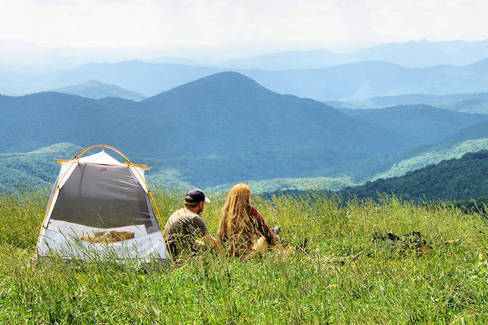
Blue Ridge Hiking Company
Expert guides offer a wide array of hiking excursions, including outfitting gear. In addition to group hikes, they can also customize a trip just for you. Experience sunsets, waterfalls and high… read more
Expert guides offer a wide array of hiking excursions, including outfitting gear. In addition to group hikes, they can also customize a trip just for you. Experience sunsets, waterfalls and high peaks at a variety of locations including the Appalachian Trail, the Blue Ridge Parkway, DuPont State Forest, Pisgah National Forest and more.

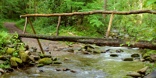
Tom Branch Falls, Indian Creek Falls and Juney Whank Falls
See three waterfalls in the Great Smoky Mountains National Park in the Deep Creek area with a two-mile hike. It is also a popular tubing and camping spot each summer. Near Bryson City.
See three waterfalls in the Great Smoky Mountains National Park in the Deep Creek area with a two-mile hike. It is also a popular tubing and camping spot each summer. Near Bryson City.
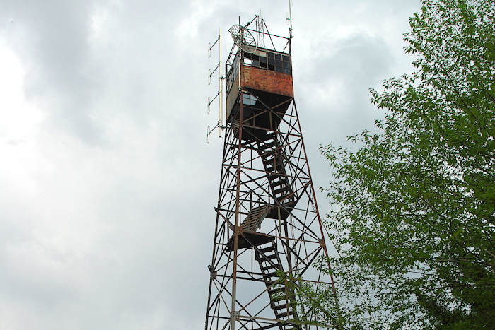
Mt. Sterling
(5.4 miles round-trip, strenuous) Atop Mt. Sterling (5,842 ft. elevation) is the historic, 60-ft. tall steel fire lookout tower with nice views. You will climb 2,000 ft. in elevation.
(5.4 miles round-trip, strenuous) Atop Mt. Sterling (5,842 ft. elevation) is the historic, 60-ft. tall steel fire lookout tower with nice views. You will climb 2,000 ft. in elevation.

Mt. Cammerer
(11.8 miles round-trip, strenuous) The hike up from Big Creek is a 5.9-mile constant climb with a gain of about 3,000 ft. in elevation. The stone fire tower on top affords fabulous views as your… read more
(11.8 miles round-trip, strenuous) The hike up from Big Creek is a 5.9-mile constant climb with a gain of about 3,000 ft. in elevation. The stone fire tower on top affords fabulous views as your reward for the climb.

Andrews Bald
(4 miles round-trip, moderate) At an elevation of 5,920 ft., this is the highest grassy bald in the Great Smoky Mountains. The hike near Clingmans Dome is not overly strenuous but includes a good… read more
(4 miles round-trip, moderate) At an elevation of 5,920 ft., this is the highest grassy bald in the Great Smoky Mountains. The hike near Clingmans Dome is not overly strenuous but includes a good bit of uphill and rocky sections. And you won't see the crowds that you find on other hikes in the Smokies.
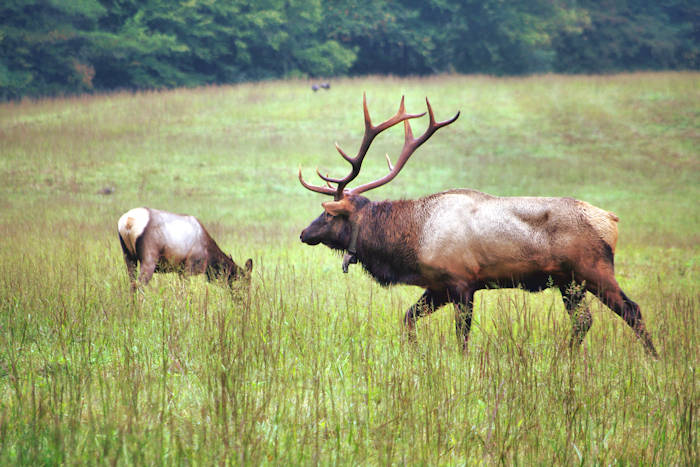
Cataloochee Valley Hiking
There are many hiking trails in beautiful Cataloochee Valley, home to the elk. A quick favorite is the one-mile Rough Fork Trail along the cascading stream.
There are many hiking trails in beautiful Cataloochee Valley, home to the elk. A quick favorite is the one-mile Rough Fork Trail along the cascading stream.

Charlies Bunion
(8 miles round-trip, strenuous) Hike the Appalachian Trail from Newfound Gap north four miles to this rocky ridge with spectacular views in the Great Smoky Mountains National Park. You climb about… read more
(8 miles round-trip, strenuous) Hike the Appalachian Trail from Newfound Gap north four miles to this rocky ridge with spectacular views in the Great Smoky Mountains National Park. You climb about 1,600 ft. in elevation, but it's gradual.
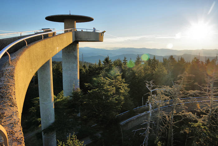
Clingmans Dome Trail
(1 mile round-trip, moderate) At 6,643 ft., this is the highest point in the Great Smoky Mountains National Park. An uphill, paved trail takes you to the top for panoramic views from the… read more
(1 mile round-trip, moderate) At 6,643 ft., this is the highest point in the Great Smoky Mountains National Park. An uphill, paved trail takes you to the top for panoramic views from the observation tower.
Great Smoky Mountains Hiking Tips
Safety is important to consider when exploring the backcountry - especially in the remote areas of the national park. Here are a few basics to help you get started:
- Backcountry camping requires a permit. See our Great Smoky Mountains Camping Guide.
- Let someone know your route and return time.
- Always hike with another person.
- Carry a current park trail map.
- Don't expect cell phone reception.
- Carry two small flashlights or headlamps.
- Take adequate water - minimum two quarts per person per day.
- All water taken from the backcountry should be treated.
- Wear shoes or boots that provide good ankle support.
- Carry a small first aid kit.
- Check the current weather forecast and be prepared for quickly changing conditions.
Pets
Dogs are allowed in campgrounds, picnic areas, parking areas and along roads, but must be kept on a leash at all times. The leash must not exceed 6 ft. in length. Pets are only allowed on two short walking paths--the Gatlinburg Trail and the Oconaluftee River Trail. Pets are not allowed on any other park trails. Pets should not be left unattended in vehicles or RVs.
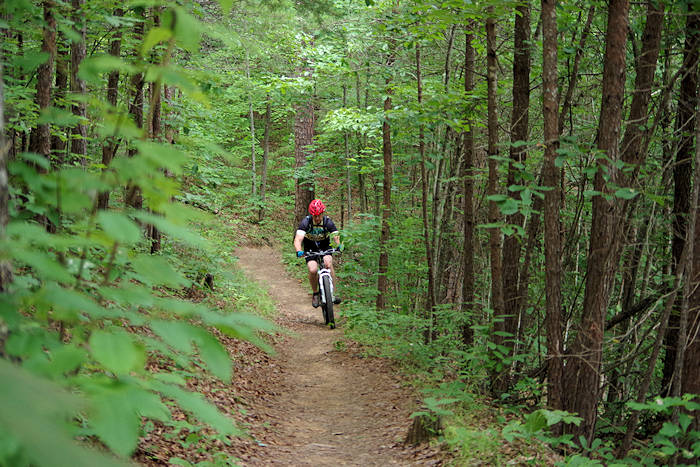
Mountain & Road Biking Trails
Bicycles can travel on most roads within the park. However, due to steep terrain, narrow road surfaces and heavy automobile traffic, many park roads are not well-suited for safe and enjoyable bicycle riding. There are no mountain biking trails in Great Smoky Mountains National Park. The Oconaluftee River Trail and the lower Deep Creek Trail are the only park trails on which bicycles are allowed. Bicycles are prohibited on all other park trails. For the mountain biking mecca, go to nearby Tsali Recreation Area in the Nantahala National Forest.
Fishing, Camping, Watersports, Waterfalls & More
For more outside adventures, see our Great Smoky Mountains Outdoors Guide.