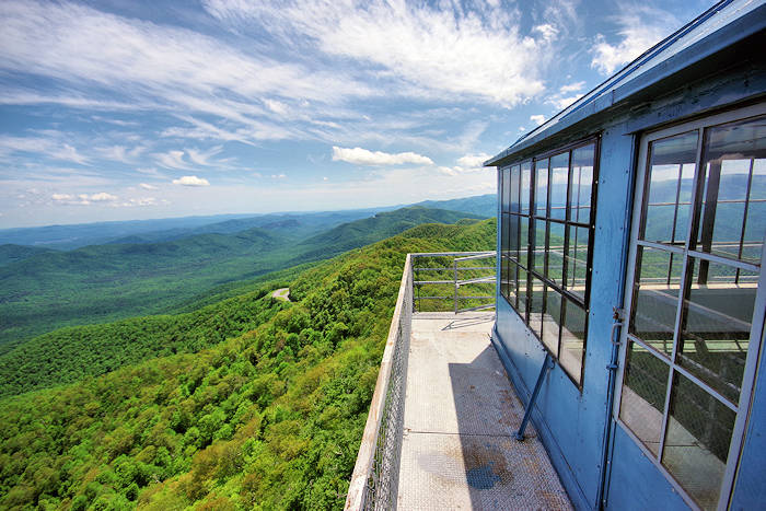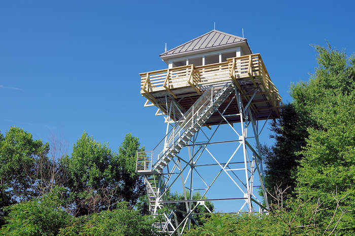
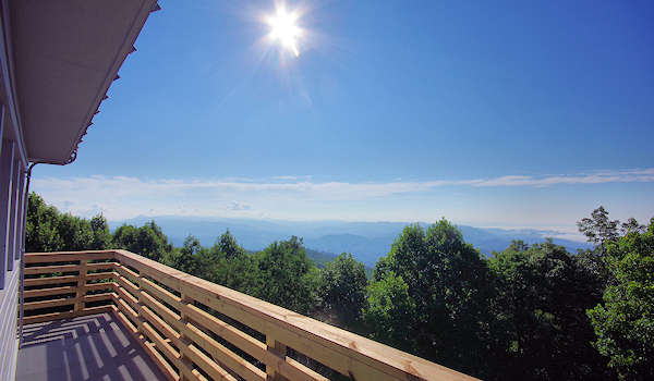
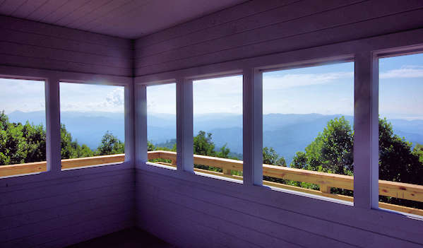
Near Hot Springs is the historic fire lookout tower on Rich Mountain (3,643 feet elevation), located in Madison County in the Pisgah National Forest. From the top of the tower, enjoy beautiful panoramic mountain views on the NC / TN state line. You can access the tower by car or by hiking the Appalachian Trail. Great news! The tower was restored in Spring 2018 through a partnership with the North Carolina Forest Fire Lookout Association, Appalachian Trail Conservancy, and US Forest Service.
To reach the 31-foot tall tower, drive US 25/70 east for 2.8 miles from Hot Springs. Look for the Appalachian bridge that crosses the highway at Tanyard Gap. Just past the bridge, turn left on a paved side road. Immediately, you have a choice to turn right to drive to the tower or left to park for the hike.
Hike to Rich Mountain
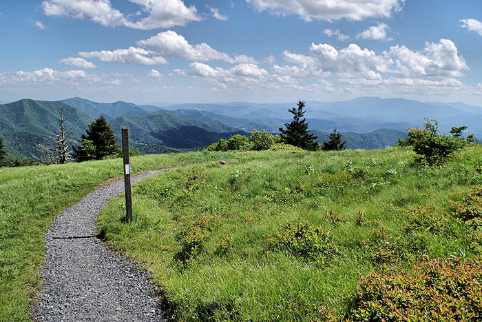
Turn left for a small parking area just before road turns left over the highway. Take the Appalachian Trail north for 2.4 miles to Rich Mountain (don't cross the bridge over the highway - hike the opposite direction - look for white blazes). The AT enters the forest at a small sign. It's an uphill hike, gaining about 1,400 feet in elevation. If you go south on the AT, Hot Springs is 5.9 miles hike. If you hike from the town of Hot Springs - it's 5.9 miles to Tanyard Gap with a 2,200+ foot in elevation gain.
Drive All the Way
To drive to the top of Rich Mountain, turn right on the paved, former two-lane highway that is now overgrown a bit. Drive downhill a short distance to the road's end. Turn left on the gravel road and drive six miles up to the tower. There is very little traffic on this curvy, mountain road. But it's a one-lane road with two-way traffic, so go slow! We recommend a high clearance car since there are usually some bumpy parts. Usually, 4-wheel drive is not necessary. After traveling five miles, you reach the Tennessee state line for Cherokee National Forest at Hurricane Gap. Turn left here to drive the last mile to Rich Mountain. At the top, there's a circle drive around the summit. There is no parking area, but there's enough room to pull to the side of the road at the end. The road is usually closed for winter months.
History
The lookout tower was erected by the United States Forest Service in 1932, capped by a 14-by-14-foot live-in cab. The tower was actively staffed until the 1990s, however, it ceased to be a live-in lookout in the 1970s. Aerial detection by planes and later, reporting by the public via cell phones, became more cost effective and time efficient. The majority of fire towers across North Carolina were dismantled. The tower at Rich Mountain had fallen into disrepair in recent years from stresses of weather extremes and vandalism.
In 2018, a partnership comprised of the US Forest Service, Appalachian Trail Conservancy, Forest Fire Lookout Association, and Carolina Mountain Club joined forces for a complete restoration. Much of the funding came from the Appalachian Trail Conservancy’s (ATC) License Plate Grant Program in North Carolina and Tennessee (because the Rich Mountain lookout tower rests half in each state). Work included a full structural overhaul including new roofing, wooden cab walls and deck railings, lightning rods and grounding wiring, fresh paint, and installation of durable, vandal-proof metal-grate flooring and stairs.
The Carolina Mountain Club—who maintains the 93-mile section of the Appalachian Trail that includes Rich Mountain—also constructed a log staircase leading to the base of the tower and performed tree work around its perimeter to preserve the scenic view. A decade ago, the NC chapter of the FFLA advocated for the rehabilitation of several other fire towers in the Pisgah and Nantahala National Forests, which led to the restoration of seven other lookouts utilizing funding from the American Recovery and Reinvestment Act. Rich Mountain is one of six remaining fire lookout towers on the Appalachian Trail within North Carolina and Tennessee.
Find more historic fire lookout towers to climb in the NC mountains.
Directions from Asheville
Sorry, no GPS address for this spot. The tower is about 35 miles north of Asheville. Drive US Highway 25/70 north from I-26 in Weaverville. About 21 miles from I-26 (past Marshall), you'll come to an intersection for NC 208. You'll need to turn left to stay on US 25/70. From that turn, drive 1.9 miles to the road on your right. Then follow directions about for hiking or driving to top.
Read about more things to do in Hot Springs. On the way back to Asheville, stop in downtown Marshall for a bite and exploration. See our Marshall Insider's Guide.