A favorite hike for locals, the Rattlesnake Lodge Trail is a fun trip back in time. You hike to the "ruins" of a lodge that was built and enjoyed by many in the early 1900s. It burned in 1926. There are two trails that lead to the site: a 1.4 mile gradual climb from Ox Creek Road and a 1/2 mile steep climb from the Blue Ridge Parkway. The hike from Ox Creek Road is about 14 miles north of downtown Asheville (7 miles east of Weaverville). This trail is part of the Mountains to Sea Trail.
This is a tragic romantic story. Rattlesnake Lodge was the summer home for Dr. Chase P. Ambler and his family beginning in 1904. His wife died in 1918 and he never returned to the Lodge. He sold it and it burned in 1926. Read more about the home and the surrounding buildings below.
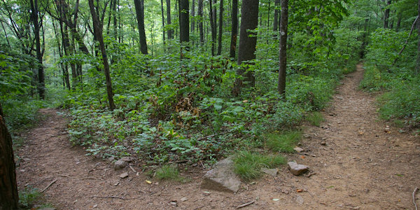
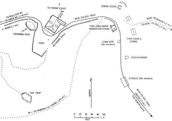
The trail/road from Bull Gap (Ox Creek Road) to the lodge was built to be four feet wide, not suitable for the horse and carriages of that day. This was done on purpose, in order to maintain as much privacy as possible, and to permit the place to have a feeling of remoteness. About halfway to the Lodge is a nice view of the mountains. The rock foundation of the Cow Barn is on the right as you approach the lodge area on the Mountains to Sea Trail (from Ox Creek Road). The pool was only a few of feet deep, for safety, and being fed by a mountain spring, was quite cold. The water was furnished by an underground aqueduct.
The remains of the spring house are underneath a fallen tree (great for climbing!). The spring in the rear supplied running water through the bottom of the once fully enclosed house to keep it cool for the milk and other goods stored there. A nice informational sign marks the spot of the lodge. Actual elevation is around 3,700 (not 4,400 that is reprinted on the sign).
Extend you hike by another mile: The main reservoir is about a quarter mile up a steep side trail which starts beside the large fallen tree over the spring (Blue Blaze). The reservoir, obviously roofed over for protection from the local wildlife, received water from two sources. One was from a spring at the site, which can be seen just above the reservoir, through a built-up, coverless manhole. Continue up the mountain on the trail to the other source, a spring on the Mountains to Sea Trail. This side trail is on top of the ditch dug for the water pipe. A piece of terra cotta pipe can still be seen in the middle of the trail, just beyond a rocky area shortly before reaching the upper spring. Take a right on the Mountains to Sea Trail to loop back down to the lodge area. About a quarter mile past the lodge and a small stream on the Mountains to Sea Trail is the fallen rock chimney of "The Shack." A simple board cabin, with bunk beds and a fireplace, it was built for the lodge construction workers. Later it became a guest cabin, available gratis to anyone hiking or riding through on the way to Craggy Gardens and Mt. Mitchell. One of the trails to the Parkway intersects the trail here.
Driving directions from Asheville: From I-240, take Exit 4A for US Highway 19/23 north toward Weaverville. Go six miles and take Exit 21 for New Stock Rd. At the end of the ramp, turn right and a quick left and drive past Ingles grocery store. Go 8/10 mile. At stoplight, turn right onto Reems Creek Road. Go four miles and turn right onto Ox Creek Road. Go about 3.5 miles to a small parking area on the left (for 3-4 cars). From the parking area, follow the trail for a short distance where it intersects with the Mountains to Sea Trail (white blaze). Turn left on the trail and head up the switchbacks. 1.4 mile to the lodge site. (When you return to your car, you can continue one mile on Ox Creek Road to the Blue Ridge Parkway. Just before you reach the Blue Ridge Parkway, Elk Mountain Scenic Road is on the right. This is a nice drive back to Asheville.)
From the Blue Ridge Parkway: Go to Milepost 375 to a small parking area just before the Tanbark Ridge Tunnel. Follow trail beside the cascading stream. For a loop trail (about 1.2 miles total): After a short distance up the trail, turn left, up the steps and continue uphill for about 4/10 of a mile to the lodge site. (Blue Blaze) You will intersect the Mountains to Sea Trail at the lodge ruins. Turn right onto the trail and go about 1/4 mile to a rock chimney. Look for the trail to the right (blue blaze), and take this back to the parking area.
The History of Rattlesnake Lodge
By A. Chase Ambler, Jr.
The lodge was built in 1903 and 1904 to be a summer home for Dr. Chase P. Ambler and his family, and it served as this until it was sold in November of 1920. The children and their mother went to the lodge when school was closed for the summer, and returned to Asheville just before school opened in the fall. Dr. Ambler, who had a medical practice in Asheville, would always come up on the weekends and usually on Wednesdays. He also spent many of his vacations there, and frequented the lodge during winter and spring. He especially spent a lot of time there during the first several years, when the out-buildings and the trails were being built.
The lodge had a separate dining room, between the front living room and the kitchen. Meals were eaten there with the whole family together. The cook was Kate Donovan, affectionately known as Dits. (Her sister was the author's "nanny".) Kate had her own room in the lodge during the summers. The kitchen housed the hot water heater, which was heated by a wood stove.
The living room ceiling was covered with rattlesnake skins. During the first three years, it has been written that 41 rattlesnakes were killed on the property. It was understood throughout the area that Dr. Ambler would pay $5 for any rattler brought to him. As $5 in those days was about equivalent to week's wages, many rattlers undoubtedly came from very far away!
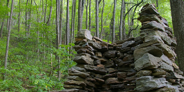
There were three large fireplaces on the main floor: One served the living room, one the dining room and one a bedroom. All three used the same chimney. Over the living room in the front of the lodge was a large guest bedroom, which contained bunk beds. Normally, visitors would stay in this room, especially during the summer when the children were at the lodge. The furniture in the lodge, including cupboards, tables, chairs and bedsteads, was built at the lodge from wood taken off the property. Mattresses, springs and cooking utensils were obtained in Asheville.
A footbridge extended from the second floor to the bank, towards the terraced gardens and tennis court. The main "road" through the property went under this bridge, between the lodge and the bank. There were also some outside steps, meeting the bridge at the top of the bank.
The lodge had a back "porch," which was really part of the house and contained the stairs to the second floor and the bedrooms. The two side porches were covered, and the one towards Bull Gap served as a small "wood shop" for Dr. Ambler's woodworking and carvings. The front porch was the normal gathering place for family and friends. It was wide and had no roof, yet it was still shielded from the southwest sun by the trees.
All the logs in the lodge, and all other out-buildings, were hand hewn chestnut. The doors in the lodge were chestnut plank. The lodge burned from some unknown cause, believed to be lightning, about 1926.
TOOL SHED: The hand hewn log tool shed was in front of the spring house. The shed was at ground level with the existing path. Electricity for the lodge came from a water-driven generator, which was located in the bottom of this shed. The cement pedestal for the generator can still be seen, with several bolts showing where the generator was mounted. A pipe from the reservoir still protrudes towards this stand.
CARRIAGE HOUSE: Since there was a good public road over Bull Gap, a carriage house was built at the gap (near Ox Creek Road). Today, only the rock remains can be seen. This carriage house stored the carriages from Asheville, and then the family or visitors walked to the lodge, or transferred to horses or to a specially built, narrow axle carriage. The brave rode the sled. The sled was also constantly used as a working sled around the lodge site, hauling stones for building, or fruits and vegetables from the fields and orchards.
THE DEN: This area below the lodge site can be easily reached by leaving the yard to the south (left, facing away from the mountain), over a large, flat boulder. Although in the various writings it was sometimes referred to as the "schoolroom," it was more than likely a quiet place to which the adults could retreat.
CARETAKER'S CABINS: These cabins were next to the spring house and were made with hand hewn logs. The caretaker and his family lived on the property year around, and cared for the livestock during the winter. The larger three room cabin was built first and then the smaller one added when his family grew. Only the chimney stones remain today.
POTATO HOUSE: This small storage "house" was located about 50 yards south of the spring house. The rock entrance to the "bank house," as it's normally called, can still be seen, although it is somewhat fallen down. Shelves were on each side for storing vegetables, fruits and other goods. Two corn cribs were opposite the potato house at the edge of the retaining wall.
HORSE BARN: Nothing remains of the stables which housed the horses, except the long rock retaining wall for the area where it once stood. The log structure was just beyond the potato house and was located at the edge of the wide trail, with access from the bank side. A pipe for water to the area can still be seen above the trail on the bank. This pipe probably came from a small spring just east of the stable, where today a fairly strong stream crosses the Mountain-to-Sea trail. A pig lot used to be located "in" this stream.
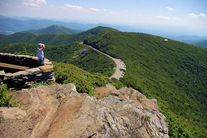
LAND: The first parcel of land, 293 acres, was bought in October of 1902, and additional acreage soon brought the total to 318 acres, directly around the lodge site. This original acreage extended from Bull Gap up the ridge to Rocky Knob (once called High Knob), and over Sassafras Gap to High Swan (once called Ray Knob) and down Tanbark Ridge. This natural "amphitheater," easily seen from the Tanbark Ridge overlook on the BRP, was chosen because of the shielding on three sides. During the next years, Dr. Ambler purchased more land surrounding this property. The Shope Creek area, consisting of 1,000 acres, including the ridges of Lanes Pinnacle, Wolfden Knob, Rich and Rocky Knob, were obtained. He also bought 300 additional acres down into the Ox Creek area. The government bought this additional surrounding land of 1,300 acres in 1916 for $10 per acre, and it became part of Pisgah National Forest, and later, part of the Blue Ridge Parkway.
The original land of 318 acres was sold in 1920 and was resold several times after that. The Blue Ridge Parkway obtained a right-of-way in the 1930s, and in 1976, what was left of the original tract was sold to the Parkway. This purchase was extremely beneficial for the public, as now the property is protected from developers. The Parkway not only owns this amphitheater, it fortunately owns other property outside of their "normal" right-of-way, beyond the lodge area all the way to Potato Field Gap. The Mountains to Sea Trail on this old Ambler property is a delightful hike, as it is far removed from the Parkway itself, and little traffic noise reaches the hiker. The Carolina Mountain Club maintains the Mountains to Sea Trail, with the cooperation of the Parkway.
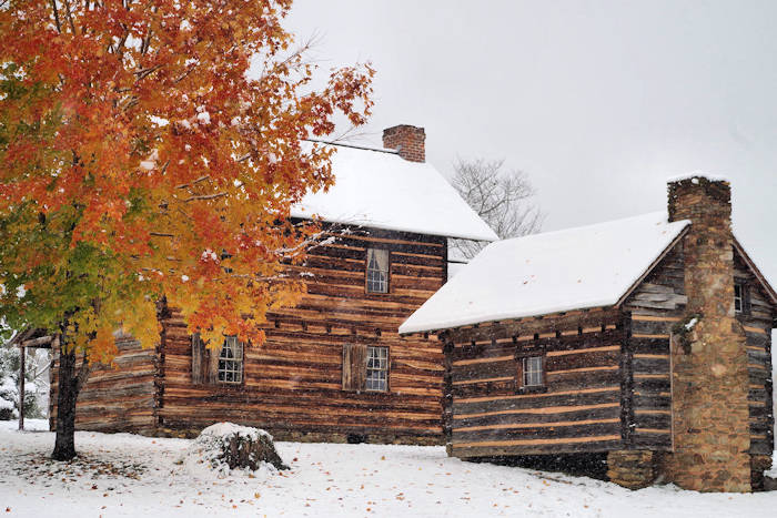
Nearby is the historic site of Vance Birthplace.