Limited-Time Offer: Save $50 on a Biltmore® Annual Pass
Buy Your Pass

A short drive (20 miles) from downtown Asheville takes you up, up, up on the Blue Ridge Parkway to mile-high Craggy Gardens. As you approach the area, you will first see a sign for the Craggy Picnic Area to the left. It's a short drive up the mountain to many picnic tables and a gorgeous hike across the bald. Continue straight on the Parkway a few more miles to reach the Visitor Center for east and west panoramic views. Enjoy the crisp air, summer rhododendron and super scenic trails. Since this location is more than 3,500 ft. higher in elevation than Asheville, temperatures tend to be 10-20 degrees cooler than the city. If you are greeted by low clouds and fog, wait a bit. The weather often changes quickly.
There are three sections to visit. They don't have GPS addresses, so watch for mileposts along the Parkway:
- Milepost 367.6, Craggy Gardens PicnicGround & Craggy Gardens Trail to Craggy Flats (elevation 5,680 ft.) - open late May-October
- Milepost 364.4, Craggy Gardens Visitor Center at the Gap (5,497 ft.) - open late May-October
- Milepost 364.1, Hike to panoramic views from Craggy Pinnacle (5,892 ft.)
When do rhododendrons bloom? Usually in early to mid June, the pink and purple blooms of Catawba rhododendron peak. The best place to see these natural gardens is a short (1/3 of a mile) hike from the Visitor Center parking area via Craggy Gardens Trail (read more below).

The Craggy Gardens picnic grounds have plenty of tables. It's a short drive from the Parkway.
The Great Craggy Mountains are an area of exposed rock surfaces and high peaks that provide breathtaking views of distant southern Appalachian ridges. Large expanses of native rhododendron cover the slopes and summits of the Craggies. The area has long been known as Craggy Gardens. Throughout the summer, smaller native wildflowers cover the ground with vibrant splashes of color. These natural garden meadows are "balds."
Red berry bouquets of the mountain ash appear each fall. The berries are often encased in ice in the fall and winter. The combination of high altitude, cool weather and exposed rocky outcrops creates the necessary habitat for a number of rare and endangered plants. Craggy Gardens has been recognized by the state of North Carolina as a Natural Heritage Area.
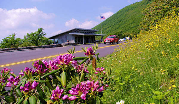
While the Visitor Center is only open in the summer and fall, the parking area remains open. Due to extreme winter weather, the Parkway is closed much of the winter in this area.
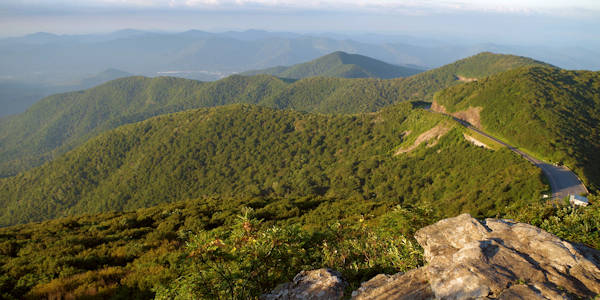
Just a part of the 360-degree panoramic view from atop Craggy Pinnacle. Read more.
Craggy Gardens Hikes
Note: There are many fragile habitats with rare plants. Please stay on the designated trails.
Our favorite hike here is the Craggy Pinnacle Trail. It's a 1.5-mile round-trip hike to the top for exceptional panoramic views (pic above) that are hard to top in Western North Carolina. See our Craggy Pinnacle Guide.
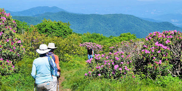
The Craggy Gardens Trail (above) can be accessed from the south end of the Visitor Center Parking area or from the north end of the Picnic Area. From the Visitor Center, the trail begins as a self-guided nature trail with a moderate uphill climb for 3/10 of a mile to a large trail shelter atop Craggy Flatts. A short spur to the left crosses the rhododendron bald to an overlook - this is the best spot to see the rhododendron display in early to mid June. If you begin at the Picnic Area, it's an 8/10 of a mile uphill hike to the shelter and bald area. See our Craggy Gardens Trail Guide.
The Douglas Falls Trail follows the Mountains-to-Sea Trail from Craggy. The 7-mile round-trip hike starts from the Visitor Center parking lot. It's a strenuous trek and recommended for only experienced hikers. Sometimes the trail is difficult to follow and there are some rugged sections as you descend more than 1,300 feet. You can more safely hike to the 70-ft. Douglas Creek Falls from the Barnardsville area (read more).
Download a PDF Craggy Gardens Trail Map.
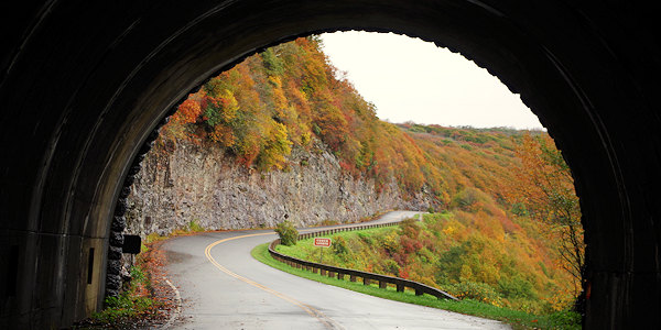
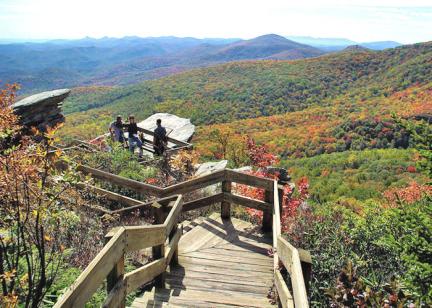
Peak fall color is early October.
Directions: Drive north on the Blue Ridge Parkway from Asheville, about 18 miles north of the Folk Art Center on the Parkway (near U.S. 70 exit) or take scenic Town Mountain Road from downtown to the Parkway and turn left (about 20 miles total). This section of the Parkway closes frequently during the winter for snow and ice. Read more about current Parkway closures.
Check out this 360 video of Craggy Gardens Hike by our friends at Hike NC With Me
I Love Craggy Fundraiser: Thank you for helping us raise funds for much needed repairs at Craggy. Read more!