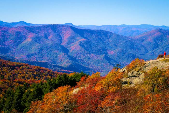
Many of you have probably seen the above view of Looking Glass Rock (elevation 3,970 ft.) from the Blue Ridge Parkway, south of Mount Pisgah and near Graveyard Fields. The stone face in Pisgah National Forest looks impossible to hike, and you sometimes see professional rock climbers on this impressive peak.
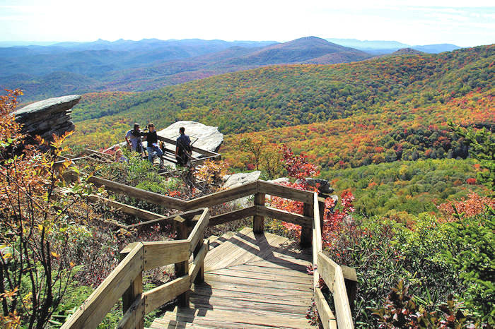
Good news! If you drive around to the other side of Looking Glass Rock in the Brevard area, you will find a very walkable hiking trail to the top, where you can enjoy the great views looking back toward the Blue Ridge Parkway. The Looking Glass Rock Trail, located off the Forest Heritage Scenic Byway, is extremely popular and can be a bit crowded on warm weather weekends. It's perfect for a winter hike. (Be careful of ice on the rock face at the top in cold weather.) It's only about 45 minutes from downtown Asheville.
The Looking Glass Rock Trail climbs about 1,700 ft. in just over three miles (6.5 miles round-trip, allow 4-5 hours). The many switchbacks along the way help make for a long and moderately difficult climb. A strong hiker can make it to the top in 1.5 hours and down in one hour. The views from the top are well worth the effort. The trail is well blazed in yellow and easy to follow.
The trail starts off following a stream with some small cascades along the way, before beginning a series of switchbacks up the mountain. Sections of the trail take you through tunnels of rhododendron and mountain laurel.
After about two miles, the trail reaches a flat rock area, which is used as a helicopter pad by the local rescue squad for injured rock climbers. This is a good resting spot. A spur trail heads off to the left past the helipad, which leads to some nice views from Lower Looking Glass Cliffs.
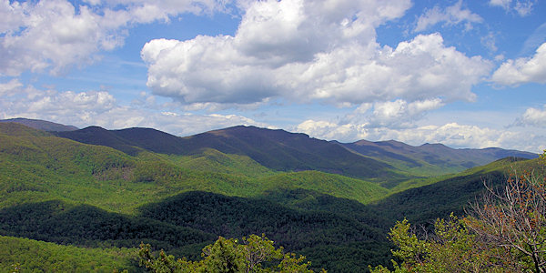
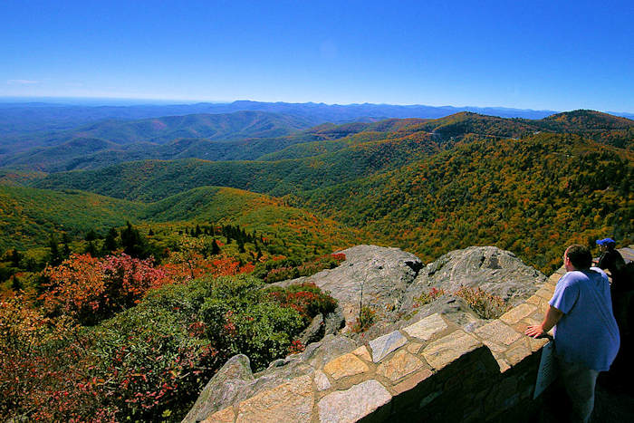
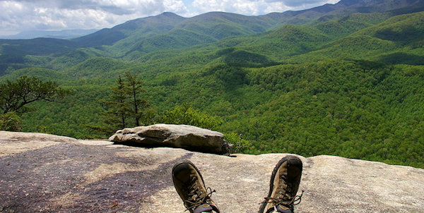
From the helipad, continue on the main trail to the summit. At the actual summit, there are a couple of nice campsites, but no views. Keep walking! The trail continues past the summit and after a short descent, you will arrive at Upper Looking Glass Cliffs, where you will be treated to some spectacular views. Do not get too close to the edge! It is very easy to slip, and a fall from here would most certainly be fatal.
Take some snacks or lunch in your backpack and enjoy a picnic with an amazing view at the top. As with every hike, take plenty of water. The nearest restrooms and vending machines are at the nearby Center for Wildlife Education.
Nearby are Looking Glass Falls, Sliding Rock, Log Hollow Falls, Cove Creek Falls, Slick Rock Falls, Moore Cove Falls, John Rock hike, Daniel Ridge Falls hike, Pink Beds hike and the Cradle of Forestry.
Directions from Downtown Asheville (about 36 miles): Take I-240 West / I-26 East. Continue on I-26 East to Exit 40 for Highway 280 (and the Asheville Airport). Take a right onto Highway 280 West and go 16 miles toward Brevard. As you enter the Brevard area, you will see a big shopping center on the right (with Wal-Mart). Just past the center, turn right onto US Highway 276 North (Forest Heritage Scenic Byway) to enter the Pisgah National Forest. Go 5.3 miles and turn left at the sign for Pisgah Center for Wildlife Education and the State Fish Hatchery. Go 4/10 of a mile and look for the parking area on the right for Looking Glass Rock Trail Head. For more information about the many hiking trails in Pisgah National Forest, stop at their Visitors Center on US 276 on the way to the trailhead.
See our Pisgah Forest Waterfall & Hiking Map.

Brevard
Picturesque Main Street has many local shops, restaurants, galleries, brewery, museums and favorite O.P. Taylor toy store. Big events include the White Squirrel Festival, 4th of July celebration,… read more
Picturesque Main Street has many local shops, restaurants, galleries, brewery, museums and favorite O.P. Taylor toy store. Big events include the White Squirrel Festival, 4th of July celebration, Brevard Music Festival and Halloweenfest. This is the Land of the Waterfalls with hiking, biking and famous Sliding Rock.

Brevard Adventure Guide
Order your free 48-page Adventure Guide for Brevard and Transylvania County, Land of the Waterfalls, with scenic drives, hikes, waterfall map, festivals, art, museums and picturesque Main Street… read more
Order your free 48-page Adventure Guide for Brevard and Transylvania County, Land of the Waterfalls, with scenic drives, hikes, waterfall map, festivals, art, museums and picturesque Main Street.

Brevard Places to Stay
Find cabins of all sizes, hotels, B&Bs and luxury inns in the Brevard area from their official visitor center. It's the Land of Waterfalls. Includes Pisgah National Forest and DuPont State… read more
Find cabins of all sizes, hotels, B&Bs and luxury inns in the Brevard area from their official visitor center. It's the Land of Waterfalls. Includes Pisgah National Forest and DuPont State Forest.

Restaurants in Brevard
Find a variety of places to eat and drink in Brevard including upscale dining casual eateries, pubs, food trucks, bakeries, coffee shops, and more!
Find a variety of places to eat and drink in Brevard including upscale dining casual eateries, pubs, food trucks, bakeries, coffee shops, and more!
Check out this 360 video of Looking Glass Rock View by our friends at Hike NC With Me