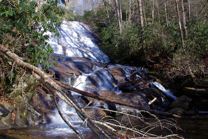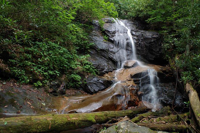
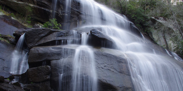
This waterfall in Pisgah National Forest near Brevard has multiple names: Tom's Spring Branch Falls, Daniel Ridge Falls and Jackson Falls. It’s an easy half-mile hike on the Daniel Ridge Trail to reach the base of this 150-ft. waterfall. As with many waterfalls, it’s most impressive after some decent rain. During summer dry spells, the flow is a tiny stream. You can either hike quick one-mile direct round-trip or the entire four-mile loop that includes the top of the waterfall.
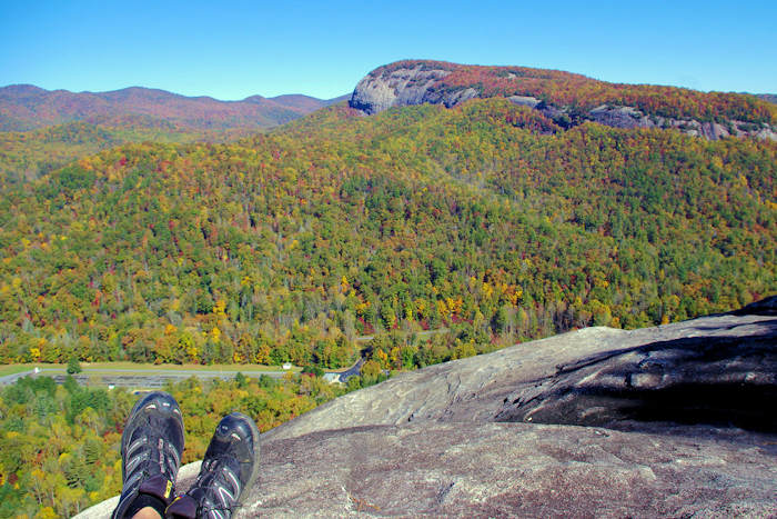
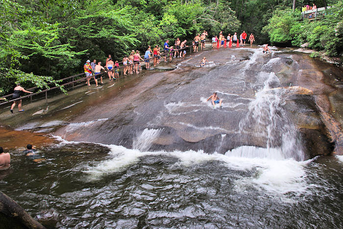
It's just a few miles from the trailheads from two of our favorite hikes, Looking Glass Rock and John Rock. Nearby waterfalls include Cove Creek Falls (less than a mile away), Slick Rock Falls, Cedar Rock Falls, Log Hollow Falls, Looking Glass Falls and Sliding Rock. It's about 14 miles from the Blue Ridge Parkway, accessed from the beautiful Forest Heritage Scenic Byway (see directions below), near Pisgah Center for Wildlife Education.
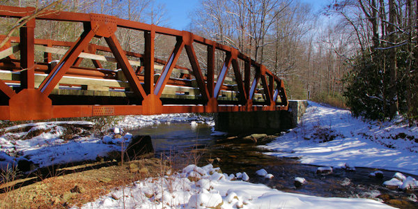
From the small parking area, walk around the gate and follow the red-blazed (and signed) Daniel Ridge Loop Trail. Cross an impressive bridge over the Davidson River and follow the trail straight ahead (a riverside trail to the left takes you to some nice camping sites). At the fork of the loop trail, go to the right to reach the waterfall. If you hike the entire loop, this is where the loop ends. It’s an easy uphill walk along an old road to the falls. You can enjoy a view in front of the waterfall or take a short side trail up to the side of the falls.
If you want to continue the loop hike and go to the top of the waterfall, head back toward the car and you will immediately see the trailhead up the mountain on the right. The total elevation gain for the loop hike is 800 feet. The loop hike includes several other cascades along the river. Be sure to follow the red blazes to stay on the main trail.
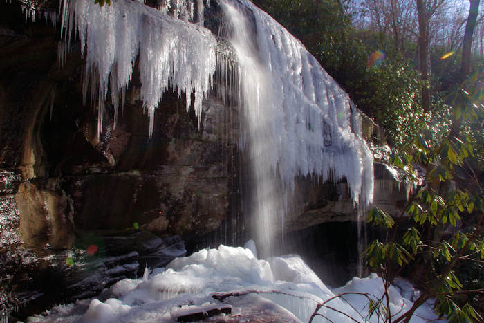
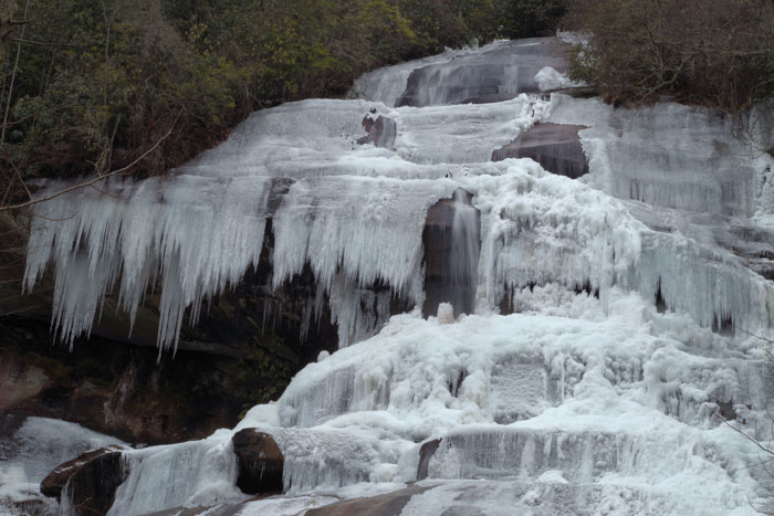
Watch our video: Frozen Daniel Ridge Falls
These trails are also open to mountain biking, but it’s not a busy biking area.
Directions from Downtown Asheville (about 40 miles): Take I-240 West / I-26 East. Continue on I-26 East to Exit 40 for Highway 280 (and the Asheville Airport). Take a right onto Highway 280 West and go 16 miles toward Brevard. As you enter the Brevard area, you will see a big shopping center on the right (with Wal-Mart). Just past the center, turn right onto US Highway 276 North (Forest Heritage Scenic Byway) to enter the Pisgah National Forest. Go 5.3 miles and turn left at the sign for Pisgah Center for Wildlife Education and the State Fish Hatchery. Go 3.9 miles and park in the parking area on the right (it's about 2.5 miles past the Pisgah Center on Forest Road #475). The last half-mile is unpaved starting at the Cove Creek Group Campground and a little bumpy.
The address for the Pisgah Center for Wildlife Education is 1401 Fish Hatchery Rd, Pisgah Forest, NC 28768. See our Pisgah National Forest waterfall map for the Looking Glass area and our Top 60 Waterfalls near Asheville.
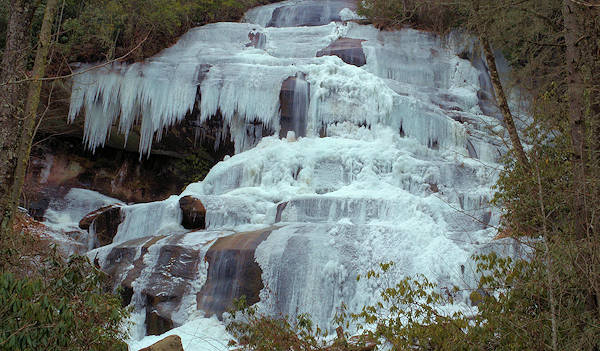
During extremely cold weather, the entire waterfall can freeze! See more of our favorite Winter Waterfalls.