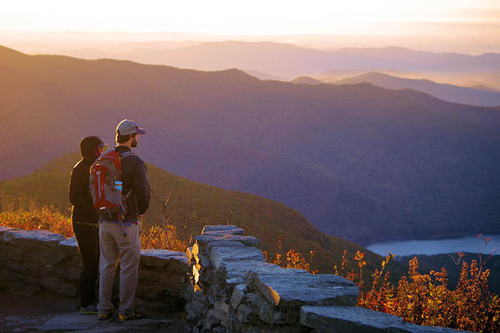
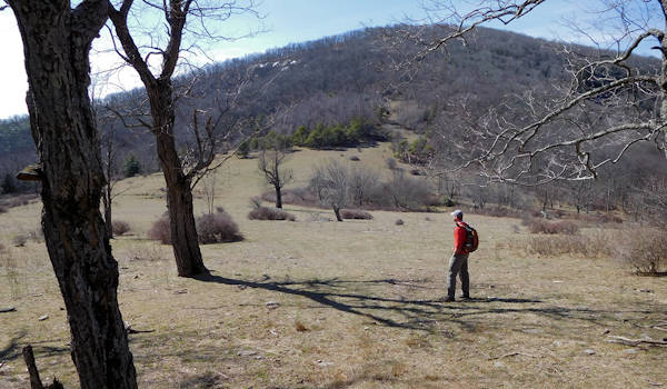
Thanks to the hard work of Conserving Carolina and their ace trailblazer Peter Barr, there's a spectacular hike to explore in the Upper Hickory Nut Gorge area. The 3-mile Wildcat Rock Trail climbs about 1,800 feet in elevation, taking you to a 100-foot waterfall, rock climbing area, towering cliffs, and a panoramic lookout point from Wildcat Rock (photo above). It ends in a highland grassland atop Little Bearwallow Mountain, elevation of 3,980 feet. It opened in April 2017.
The trail took 3 years and $200,000 to build. It was painstakingly designed to be the utmost in sustainability to protect the land, using natural materials to last many generations. This area is home to rare plant communities and a big variety of wildflowers. In fact, more than 100 acres have been designated the Little Bearwallow Mountain Significant Natural Heritage Area for its biodiversity.
Within the next few years, this trail will extend another two miles to the top of Bearwallow Mountain, connecting to another 3.5 miles of trail. This is one of the many trails that will form the much bigger Upper Hickory Nut Gorge Trail (also see Bearwallow Mountain Trail and Trombatore Trail).
The hike begins at a small parking area along US Highway 74A (Drovers Road Scenic Byway) in Gerton, located between Asheville and Chimney Rock. It's about 18 miles from downtown Asheville. It's easy to spot with an old fireplace, sign for "Upper Hickory Nut Gorge," and crosswalk.
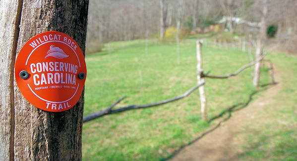
From the parking area, cross the road to begin the hike. Look for the Wildcat Rock trail marker. The first part of the trail follows a wood fence through an orchard. Follow the Conservancy orange blazes. The trail is broken down into three one-mile unofficial sections.
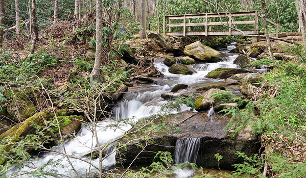
Cross a small wooden bridge over Hickory Creek and begin your ascent to Little Bearwallow Falls. This section of the trail is about a mile with a 650-foot elevation gain, gradually walking uphill most of the way. This part of the hike is classified as "challenging."
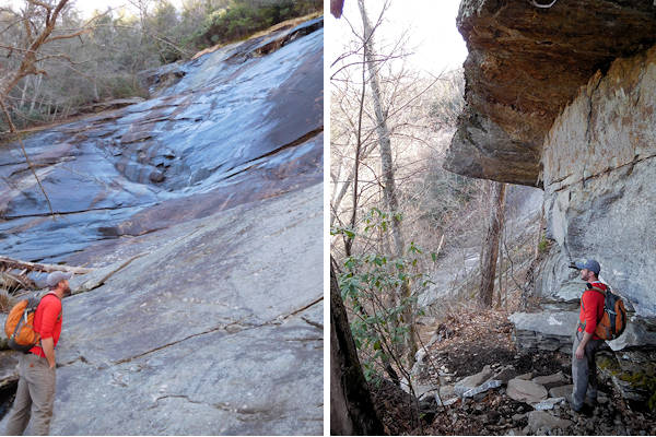
The 100-foot waterfall flows down a broad cliff, and water flow varies according to recent rain. Normally, find a small flow. But it's a gorgeous and dramatic setting. This is an ice climbing spot during the coldest winter weather - with rock climbing access all year. Thanks to Peter Barr (in the picture above) for designing such a scenic trail. In fact, Wildcat Rock Trail won the Coalition of Recreational Trails 2018 national award for trail design and construction.
The next two miles of the trail are more strenuous (classified as "hardcore"), with many stairs. It's a steady uphill climb of another 1,200 feet in elevation gain. So many turn around here. To continue, climb a steep rock staircase (impressive trail engineering!) and continue on the trail past some rock cliffs and overhangs.
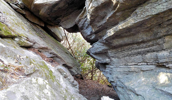
In about a mile from the waterfall, find a short but steep side trail on the left that takes you to the top of the Wildcat Rock outcropping with panoramic views at an elevation of 3,600 feet (photo at top of page). It's certainly a great picnic spot. Look for the slot canyons under Wildcat Rock - fun to explore.
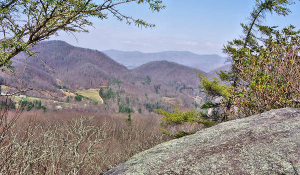
To the northwest, see Craggy Pinnacle and Gardens in the far distance. To continue your expedition, return to the trail and turn left to continue an upward trek.
After many switchbacks and rhododendron forests, you'll come out into pasture land at the summit of Little Bearwallow Mountain. The trail officially ends here (for now), but you can walk downhill to your right into a larger pasture area in the swag/gap between the peaks. This is private property, so please respect it and grazing cows. We are delighted that the owners welcome visitors. No camping allowed.
There you will find the natural spring that creates a refreshing pool for bears to wallow and keep cool (hence the name of this area). Looking straight ahead is Bearwallow Mountain. Within the next couple of years, the trail will be extended two miles to reach the top of this grassy summit.
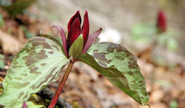
The section of trail before Little Bearwallow Falls is a prime spot for blooming toadshade trillium in late March and April.
Wildcat Rock Virtual 360 Hike & View
See the following videos filmed by our friends at Namaste In Nature! These videos were filmed using 360º 5.6K resolution, so you may need to adjust your youtube streaming quality to a higher setting for the best experience. These videos work on a desktop but seem to stream better on a mobile device.
Driving Directions: From Asheville, drive US 74A toward Chimney Rock. The parking area is about 13.5 miles past I-40. The parking area is on the left with a rock wall and chimney. But this hike starts across the road. There's a crosswalk that directs you to the trailhead. The trail is well-marked. See it on Google Maps.
Nearby
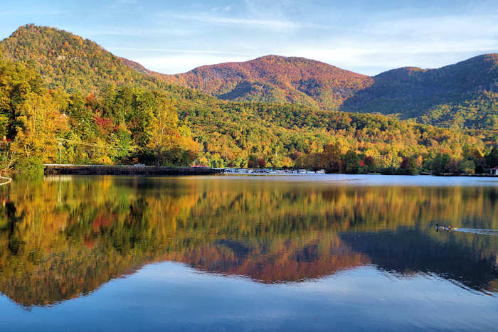
Chimney Rock Park is 6.5 miles farther down US 74A. Lake Lure is 7.5 miles. The trailhead for Bearwallow Mountain and Trombatore Trail is just 3.3 miles away.

Conserving Carolina
Since 1994, they have protected 42,000+ acres in more than 150 projects in WNC, from the waterfalls of DuPont State Forest, to the rock faces of Hickory Nut Gorge, to the farms and rivers that… read more
Since 1994, they have protected 42,000+ acres in more than 150 projects in WNC, from the waterfalls of DuPont State Forest, to the rock faces of Hickory Nut Gorge, to the farms and rivers that provide us with food and water.