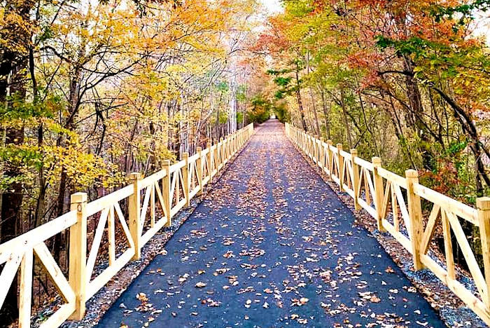
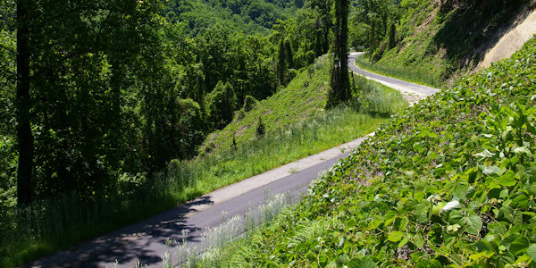
One of our favorite paved bike greenways in the Asheville area is Point Lookout Trail, a 3.6-mile trail through Pisgah National Forest and barricaded to motorized vehicles at both ends. It was formerly part of Old US Highway 70, winding through the woods with serene views of the mountains, the railroad and forest.
More About the Trail
While the trail is only 3.6 miles one way (plus another 1/2-mile from the parking area), it climbs 900 feet in elevation from Old Fort to Ridgecrest (near Black Mountain). Begin at the Old Fort entrance to bike the uphill portion first (even, gentle climb), then you can coast down on your bicycle as your reward. It's an eight-mile round-trip trek from the Pisgah Forest picnic area parking.
There are few signs directing you to the Point Lookout Trail, so we've included plenty of details for you here. Parking is available at the Pisgah National Forest picnic area near Old Fort from May through October. It's about 1/2-mile ride to the start of the trail. The picnic area has primitive restrooms. There are no other facilities along or near the trail. During the other months, parking is available at the Old Fort Visitor Center (3.5 miles away) or Andrews Geyser Park (2 miles away).
About two miles up the trail is Point Lookout with a beautiful view. Just past the overlook, you will cross the railroad and have a great view of one of the tunnels. Do not attempt to get on the railroad tracks!
If you park at the Pisgah Forest picnic area, you can easily extend your bike ride by riding out to Andrews Geyser (4 miles round-trip). Or, you can ride into Ridgecrest and to Black Mountain at the other end.
Parking & Directions
Parking is not allowed on private property, only at designated parking areas. Road shoulder areas are private property within 100 feet of the access gate on the Ridgecrest access side and is private property on the Old Fort side within 100 feet of the Piney Grove Baptist Church entry gate. Do not block trail gates. The best place to park is at the Old Fort Picnic Area, from May to October.
Driving Directions to Old Fort Picnic Area Parking
From Asheville, drive I-40 East to Exit 72 (Old Fort/Highway 70). Go about a mile, then turn left onto Old Highway 70. Go 2.4 miles to Mill Creek Rd intersection, Old Fort Picnic Area is on the left. Open from May through October. Restrooms available. To reach the trailhead from the Picnic Area, turn left on Old Highway 70 and bike 1/2-mile on "Dead End" road.
When the picnic area is closed, you should park at the Visitor Center in Old Fort or Andrews Geyser:
- McDowell County Visitor Center is located just 1/3 of a mile from I-40 at 91 South Catawba Avenue. It's about 3.5 miles to the trailhead.
- Andrews Geyser Park: From the Old Fort Picnic Ground, turn right onto Mill Creek Road and travel 2 miles. No restrooms. To reach the trailhead, bike back on Mill Creek Road to the intersection with Old Highway 70. Turn right onto "Dead End" road and bike 1/2-mile to the trailhead.
Directions to Black Mountain End
Park in Kitsuma Parking Lot: Take 1-40 to Exit #66 (Ridgecrest). Right onto "Old 70." At the stop sign, continue straight onto Royal Gorge Road, which dead ends at the parking area. No restrooms.
Restrooms
Restrooms and water are not available on the trail. Primitive restrooms are available from May through October at the Pisgah Forest Picnic Area.
Safety Tips
- Always ride on the right side of the road or trail.
- Avoid Train Tracks. Trains cannot stop quickly. A freight train traveling at 30 MPH needs a stopping distance of more than 1/2-mile. For your safety, do not approach train tracks.
- If you are walking, keep to the left of the trail as you do on the roadway.
- This trail has a number of blind spots; to avoid collisions and injury it is important to keep to the right.
- When coming upon other users, advise them of your presence by calling out "I'm passing on your left." If you have a bell or horn, please use it.
- Always ride in control of your bike, especially when going downhill. Greenway trails are not appropriate for racing.
- When stopping, let others know what you are doing by calling out "Stopping" and get off the trail so you will not hinder others.
- Hunting is allowed on public lands surrounding the trail. Know when local hunting seasons open and close and wear orange on the trail during those times of the year.
- In case of emergency, call 911. The trail is marked with mileposts, please be aware of your location when calling 911. For general questions, call the U.S. Forest Service (Grandfather District) at 828-652-2144.
Trail Regulations
- Please carry out all trash; no littering.
- The trail is closed to motorized vehicles.
- Dogs should be on a leash or be under voice control to avoid collision with other users.
- Respect other visitors and be courteous; yield to other users on the trail.
- Do not approach or feed wildlife.
- Trail is open from dawn until dusk.
The History
Long before the advent of interstate highways, US 70 was the primary east-west link across the country. Much of US 70 in North Carolina still remains open to vehicular traffic. However, one particularly scenic section overlooking the Royal Gorge in McDowell County was closed to traffic many years ago when I-40 was built over Old Fort Mountain. For years, local hikers and bicyclists used the abandoned roadbed as a trail and dreamed of the day when it could be officially opened to the public. The dream became a reality at a ceremony on October 30, 2008, when the recently completed trail was dedicated and named the Point Lookout Trail.
Nearby
While you are in the area, check out Andrews Geyser (great place for a picnic) and the quaint village of Old Fort (check out shops, restaurants and weekly music jams). See our Guide to Old Fort and Andrews Geyser. Catawba Falls hiking trail is also near Old Fort. See our Catawba Falls Guide.
More Outdoors Fun Nearby

Blue Ridge Travelers: Small Towns & Outdoors
Explore McDowell County east of Asheville, with the small towns of Marion, Little Switzerland, Old Fort and Linville Falls. Includes Pisgah Forest, with hiking, waterfalls, fishing, Lake James and… read more
Explore McDowell County east of Asheville, with the small towns of Marion, Little Switzerland, Old Fort and Linville Falls. Includes Pisgah Forest, with hiking, waterfalls, fishing, Lake James and many things to do. See their Blue Ridge Traveler's guide for details.
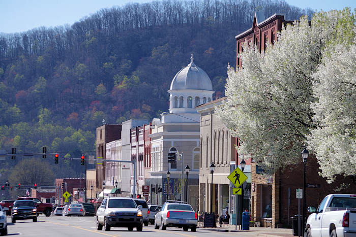
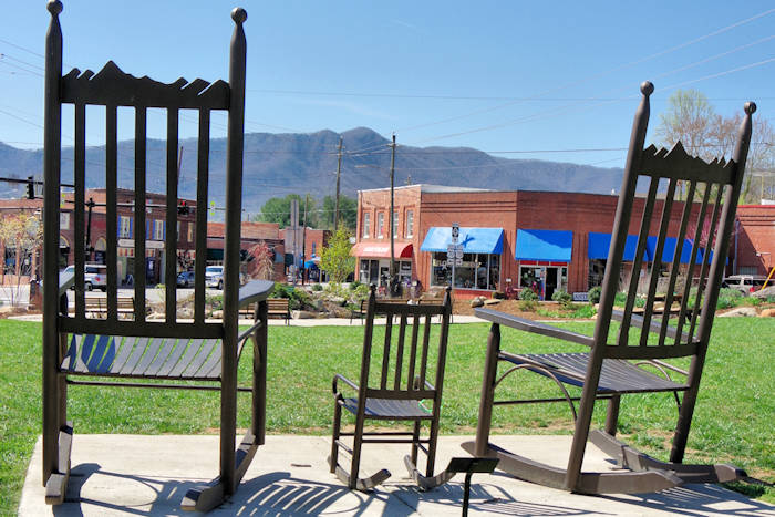
Marion
Stroll down Marion's Main Street lined with historic buildings, churches and the courthouse. It sits at the foot of the Blue Ridge Mountains near popular attractions like Mt. Mitchell and Linville… read more
Stroll down Marion's Main Street lined with historic buildings, churches and the courthouse. It sits at the foot of the Blue Ridge Mountains near popular attractions like Mt. Mitchell and Linville Falls. Don't miss the Livermush & Bigfoot Festivals!